-
... perceive the table structure in the article editing view compared to HTML table elements.
A good general rule of thumb is to avoid using a table unless you need to. Table markup often complicates page editing.
10 KB (1,399 words) - 09:34, 18 December 2008
-
|{{Hl3}} colspan="3"| '''Table of contents'''
| Hides the table of contents (TOC).
18 KB (2,251 words) - 12:18, 16 December 2008
-
:[[Attribute table]]
4 KB (349 words) - 12:26, 30 August 2011
-
...ton|text=Single lable}}. Open the '''Value''' dropdown list and select the attribute "Comment". In sub menu '''Text''' you may change font color and font size.
....png]] and click on the point. Alternatively click on a point in the ''GCP table'', right click {{button|text=Remove}}.
5 KB (794 words) - 20:23, 6 November 2021
-
... transferred to the new shapefile when using buffer or clip. The attribute table of the new shapefile simply is empty. [[User:Lburgr|- Levent]] 11:40, 15 Ja
277 B (41 words) - 10:48, 15 January 2011
-
...Importance sampling is applicable to continuous populations where the size attribute is a function from which a probability density function is derived.
...bility density function (''r''=3 along the function given above; see also Table 2).
8 KB (1,235 words) - 12:24, 26 October 2013
-
Basal area factors can be different. Table 1 gives the lengths <math>c</math> of this stick for basal area factors of
|'''Table 1.''' Length <math>c</math> of the stick with 1cm for different values of t
22 KB (3,634 words) - 07:57, 12 December 2022
-
:[[Attribute table]]
528 B (51 words) - 12:25, 30 August 2011
-
:[[Attribute table]]
4 KB (355 words) - 12:30, 2 April 2013
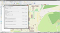 | File:RemSens Exercise02 2.png ... aerial photograph of the Uni Göttingen forest faculty and open attribute table of a GPX layer. Part of exercise 02 of the [[QGIS Tutorial 2013/14]].
(1,928 × 1,058 (537 KB)) - 08:43, 29 October 2014 |
-
# Open the attribute table of the shapefile and shift to editing mode. Press the icon of {{button|text
7 KB (1,113 words) - 08:57, 6 January 2020
-
...change the datatype to '''int''' using {{mitem|text=Processing --> Vector table --> Refactor field}}.
* Join the Land use/cover (LUC) class attribute of the selected regular points with the segments (output of Feature extract
10 KB (1,511 words) - 09:54, 15 June 2021
-
#* Adding an additional column in the attibute table:
...d|text=C_ID}} into the {{button|text=Name}} field of the {{button|text=New attribute}} section.
3 KB (456 words) - 13:41, 24 November 2020
-
...ick on Layer name in the Layers Panel and open the {{button|text=Attribute table}}.
2 KB (284 words) - 10:20, 13 May 2020
-
...|text=Class}} into the {{button|text=Name}} field of the {{button|text=New attribute}} section.
...aring layer in the layers window. Right click {{button|text=Open Attribute table}}. Report area of the clearing in hectares and perimeter in meters.
6 KB (967 words) - 13:30, 21 June 2019
-
...he right side change the ''Colors Type'' to ''Graduated Color'' and select Attribute: ''Z''. {{button|text=Apply}}. Do you observe spatial trends of local maxim
# Open the attribute table: mark the point layer ''canopy height model[Local Maxima]'' in the ''Data T
11 KB (1,790 words) - 12:58, 16 September 2014
-
...|text=Class}} into the {{button|text=Name}} field of the {{button|text=New attribute}} section.
...2010-04-30 but the exact acquisition time is not known. We may construct a table for the day of the image aqcuision listing sun elevation and azimuth with a
6 KB (1,043 words) - 13:48, 7 July 2015
-
...d|text=vpid}} into the {{button|text=Name}} field of the {{button|text=New attribute}} section.
...to ''East'' and ''North'' of the precise survey point VP1 in the attribute table {{typed|text=Festpunkte_Forstbotanischer_Garten}}.
4 KB (719 words) - 14:37, 4 July 2016

