-
:[[Vector layer properties]]
:[[Raster layer properties]]
4 KB (349 words) - 12:26, 30 August 2011
-
Display of raster data in the map canvas can be enhanced using linear histogram stretching.
... main QGIS menu and activate the checkbox as seen on the screenshot. A new Raster Toolbar is now available on the main menu.
4 KB (619 words) - 09:36, 27 October 2021
-
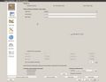
A screenshot of the raster layer properties dialog would be great! Perhaps Hans can make one? [[User:Lburgr|- Levent]]
292 B (47 words) - 13:45, 16 September 2014
-
...] and select the file ''sub_L71195024_02420050623_B40.TIF'' from ''geodata/raster/landsat/landsat457''.
...age by right-clicking on the map in the [[TOC]] and selecting {{mitem|text=Properties --> Transparency --> Adjust global transparency scale percentage}} and conf
2 KB (315 words) - 14:49, 16 September 2014
-
* Add an aerial ortho photo map as background layer. Open the Datasource manager [[Image:QGIS_3.0_datasource.png|30px]] and est
...tor layer name in the {{tool|text=Layers panel}} and {{mitem|text= Zoom to layer}}.
5 KB (794 words) - 20:23, 6 November 2021
-
# Load a georeferenced raster file as background layer (e.g. mavic_ortho_rgba_modified.tif)
... sure that the Project Cordinate reference system {{mitem|text=Project --> Properties --> CRS}} is metric, e.g. WGS84 / UTM zone 32N, EPSG:32632
1 KB (145 words) - 17:18, 14 June 2021
-
:[[Raster layer properties]]
:[[Vector layer properties]]
528 B (51 words) - 12:25, 30 August 2011
-
... color ramp of quite psychedelic colors which are assigned to intervals of raster values at random. Therefor, it does not give much extra help for interpreta
* [[Raster layer properties]]
547 B (76 words) - 12:39, 17 February 2011
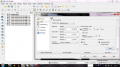
 | File:QGIS RGB dialog.jpg Screenshot of the QGIS raster layer properties RGB option (in Ubuntu).
(1,280 × 997 (93 KB)) - 15:40, 17 February 2011 |
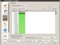 | File:QGIS colormap dialog.jpg Screenshot of the QGIS raster layer properties colormap dialog (in Ubuntu)
(916 × 681 (176 KB)) - 16:37, 17 February 2011 |
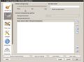 | File:QGIS raster transparency.jpg A screenshot of the raster transparency tab in the QGIS raster layer properties under Ubuntu
(916 × 678 (140 KB)) - 08:53, 18 February 2011 |
-
A nodata value simply is a pixel value in a vector or raster map representing no information. It is ''not to be confused'' with a pixel
E.g. in a raster-map containing temperatures of a surface in °C, a pixel value of 0 represe
1 KB (207 words) - 14:36, 16 September 2014
-
= Spectral vegetation index using Raster Calculator =
...} [[Image:QGIS_3.0_datasource.png|30px]] and then {{button|text=Add raster layer}} [[Image:QGIS_2.0_addrast.png|20px]] and select the file ''/geodata/lucc/
3 KB (466 words) - 17:03, 14 June 2021
-
:[[Vector layer properties]]
:[[Raster layer properties]]
4 KB (355 words) - 12:30, 2 April 2013
-
=Split multiband image into several raster images=
...an help it by using the {{button|text=Georeferencer}} in the {{button|text=Raster menu}} by rubbersheeting your orthophoto to make it fit. You'll find the in
10 KB (1,669 words) - 12:21, 21 February 2019
 | File:RemSens Exercise03 2.png [[QGIS]] 2.0 with layer properties dialogue opened for a multiband raster image. Part of [[QGIS tutorial 2013/14]] [[Exercise 03: Georeferencing]].
(1,366 × 768 (313 KB)) - 15:35, 8 December 2013 |
-
...yer ''n51_e009_e0010_merge.tif'' to a new [[QGIS]] project (from ''geodata\raster\'').
* Under the Parameter tab, select the dem file as input layer.
6 KB (915 words) - 13:49, 13 April 2018
-
... composites RGB=(B5 SWIR-1),(B4 NIR), (B3 Red) following [[Changing Raster Layer Style]] of a multiband file.
... stretch for all layers in the TOC clicking [[File:Qgis_cum_stretch.png]] (Raster Tools).
10 KB (1,485 words) - 08:56, 6 January 2020
-
# Open the layer properties (right click in [[TOC]] or double click). In the {{button|text=Style}} tab,
# Open {{mitem|text=Plugins --> Openlayers plugin --> Add Google Satellite Layer}} (figure '''A''').
7 KB (1,113 words) - 08:57, 6 January 2020
-
Mark the vector layer in the Qgis Layers window. {{mitem|text=Layer --> Properties --> Symbology --> Simple Fill}}, {{mitem|text=Fill Style}}: ''No Brush'' a
* Select the Raster layer: '''Subset_S2A_MSIL2A_20170619T_MUL.tif '''.
10 KB (1,511 words) - 09:54, 15 June 2021
-
* Create color composites RGB=9-7-3 [[Changing Raster Layer Style]] of a multiband file.
...nd in the Harz mountains after the winter storm ''Friederike''. Change the Layer Style setting to RGB=1-2-3.
14 KB (2,103 words) - 14:33, 18 January 2021
-
* Right click on Layer name in the Layers Panel {{mitem|text=Properties --> General}}. Change the '''Data source encoding''' from {{button|text=Sys
* Right click on Layer name in the Layers Panel and open the {{button|text=Attribute table}}.
2 KB (284 words) - 10:20, 13 May 2020
-
# Click the {{button|text=Add raster layer}} button [[Image:QGIS_2.0_addrast.png|20px]] and select all files with the
...om to layer}} we see only the extent of one tile. Right click {{mitem|text=Properties --> Metadata}} to obtain informations on the data type (8 bit), dimensions
5 KB (796 words) - 09:14, 6 July 2016
-
# Create a new shapefile layer
## Select {{mitem|text=Layer --> Create Layer --> New Geopackage Layer}}.
6 KB (967 words) - 13:30, 21 June 2019
-
...t loaded layer to open a viewer window. Continue with the second and third layer and confirm always ''Map Selection'' '''New''' to open new cascaded viewer
...Data tree''. On the right side of the GUI is a window displaying the layer properties. Under ''Colors'' change the Type from ''Graduated color'' to ''RGB''. Clic
11 KB (1,790 words) - 12:58, 16 September 2014
-
...d raster layer}} [[Image:QGIS_2.0_addrast.png|20px]]. Select a single band raster file.
# Right click the layer name in the Layers Panel and select {{mitem|text=Properties --> Information}}. Report on the spatial reference system, size of the imag
1 KB (169 words) - 09:11, 27 October 2021
-
== Using Layer Properties ==
...[Image:QGIS_2.0_addrast.png|20px]] and select a single or a multiband band raster file.
1 KB (198 words) - 11:44, 2 November 2020
-
...el}}. Drag the {{tool|text=Bowser panel}} window on top of the {{tool|text=Layer panel}}. Browse to your ''geodata'' folder where the tutorial data were sto
Double click on ''topo_utm32_WGS84'' to open {{mitem|text=Layer Properties --> Transparency}} and change ''Global transparency'' to about 70% by movin
2 KB (298 words) - 12:12, 2 November 2018
-
...multiband Sentinel-2 satellite image (Level 2-A product) [[Changing Raster Layer Style]] to display a true color (RGB = B4,B3,B2) and a standard false color
* Double click on a color field of some classes {{mitem|text=Layer --> Properties --> Style) to open the change color window. Change the opacity from 100% to
8 KB (1,266 words) - 11:05, 19 November 2020
-
# In the {{button|text=Layer panel}} drag the Google satellite scene to overlay the '''Subset_S2A_MSIL2A
# Open {{mitem|text=Properties --> Transparency}} and adjust the transparency of the '''Subset_S2A_MSIL2A_
4 KB (688 words) - 13:01, 30 June 2019
-
=Split multiband image into several raster images=
...an help it by using the {{button|text=Georeferencer}} in the {{button|text=Raster menu}} by rubberheeting your orthophoto to make it fit. You'll find the ins
10 KB (1,660 words) - 12:20, 10 April 2018
-
##* Set the ''Subset_S2A_MSIL2A_20170619T_BOA'' layer as {{button|text=Input image}}.
...''Input image'' is the {{button|text=''Subset_S2A_MSIL2A_20170619T_BOA''}} layer.
6 KB (989 words) - 10:22, 10 December 2018
-
... file with extension '''_Stack.tif''' {{mitem|text=Data Source Manger --> Raster}}.
...opacity of the change layer on top of Google Satellite. {{mitem|text=Layer Properties --> Transparency --> Global Transparency}}.
4 KB (632 words) - 13:06, 25 January 2021
-
* Go to {{mitem|text=Raster → Data Conversion → Convert datatype}}
...te file with extension '''_Cnv.tif''' {{mitem|text=Data Source Manger --> Raster}}.
6 KB (903 words) - 12:16, 25 January 2021
-
...utton|text=Input Image List}} select one (or optional: several) multi-band raster (multispectral images).
* Right click on the layer ''svm_classification'' and select {{mitem|text=Properties --> Symbology --> Style --> Load Style}}.
7 KB (1,086 words) - 05:41, 6 June 2022


