File list
This special page shows all uploaded files. When filtered by user, only files where that user uploaded the most recent version of the file are shown.
| Date | Thumbnail | Size | User | Description | Versions | |
|---|---|---|---|---|---|---|
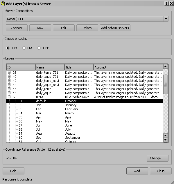
| 11:45, 21 October 2010 | Wmslayer.png (file) |  | 15 KB | Lburgr | (Screenshot of QGIS add WMS layer dialog) | 1 |
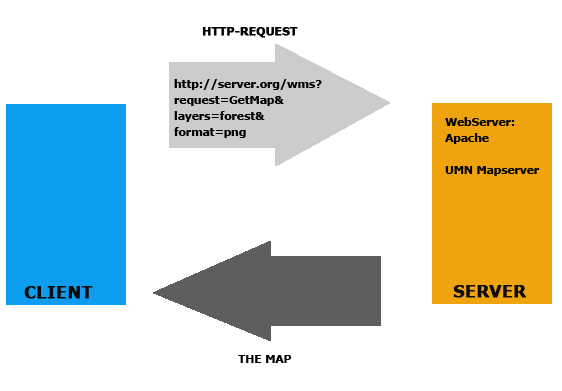
| 11:37, 21 October 2010 | Wms.png (file) |  | 9 KB | Lburgr | (Graphic depiction of the WMS data flow structure) | 1 |
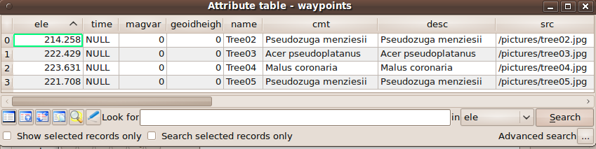
| 12:27, 26 October 2010 | Waypoints attribute.png (file) | 51 KB | Lburgr | (Screenshot of QGIS attribute table.) | 1 | |
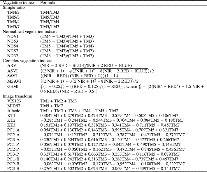
| 18:49, 27 October 2010 | Veg indices.png (file) |  | 31 KB | Lburgr | (Picture of a list of vegetation indices.) | 1 |
| 16:55, 11 November 2010 | Tux.png (file) |  | 12 KB | Lburgr | (Tux, as originally drawn by Larry Ewing.) | 1 |
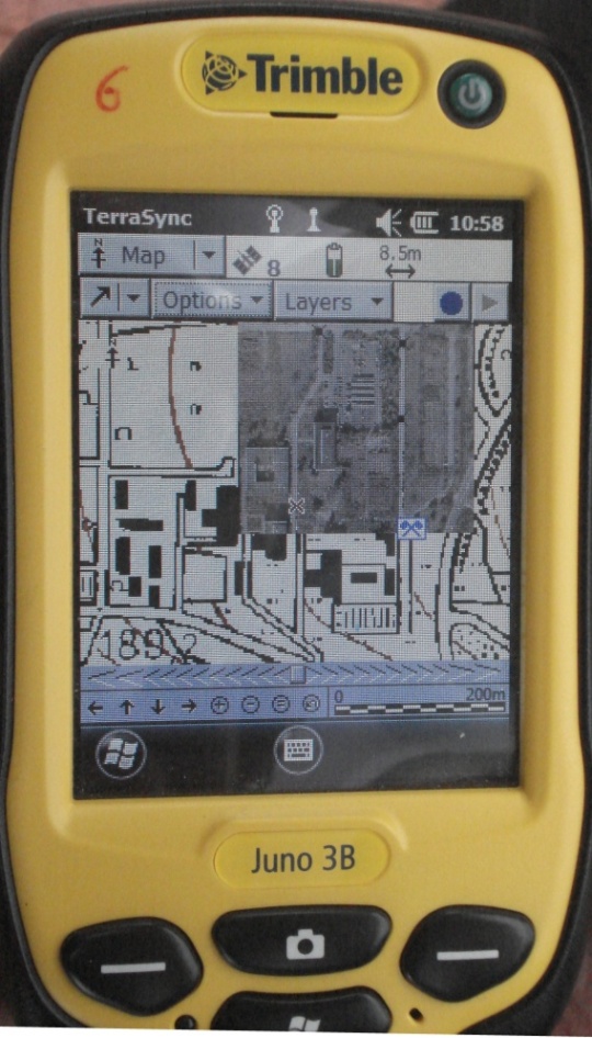
| 11:56, 26 November 2013 | Trimble Waypoints.jpg (file) |  | 177 KB | Lburgr | (Image of the ''Trimble Juno 3B'' GPS receiver with displayed waypoints and background layer.) | 1 |
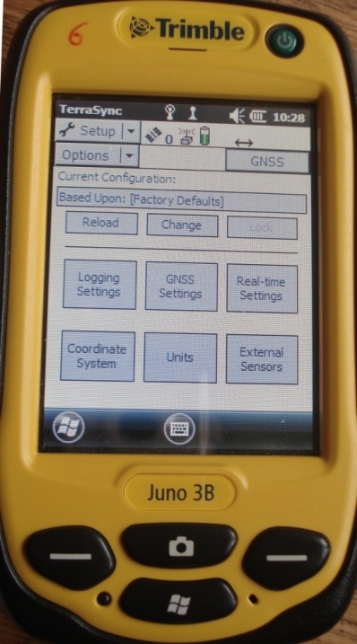
| 11:53, 26 November 2013 | Trimble Setup.jpg (file) |  | 96 KB | Lburgr | (Image of the ''Trimble Juno 3B'' GPS receiver with open setup menu.) | 1 |
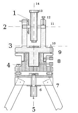
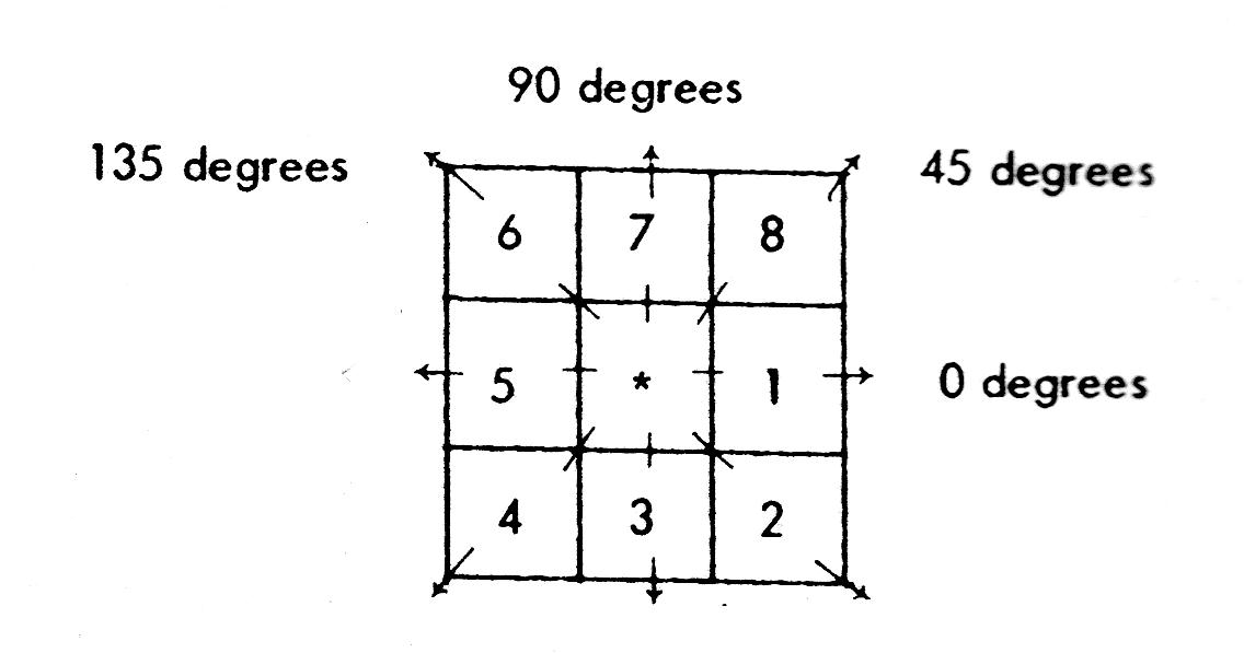
| 13:43, 1 May 2011 | Theodolit.jpg (file) |  | 36 KB | Lburgr | (Sketch of a theodolite with numbers indicating the functional parts. 1: Vertical circle. 2: Reading for vertical circle. 3: Spirit level axis. 4: Bulls eye spirit level. 5: Plumb-bob. 6: Fixation screw. 7: Tripod. 8: Clamps. 9: Horizontal circle. 10: Read) | 1 |
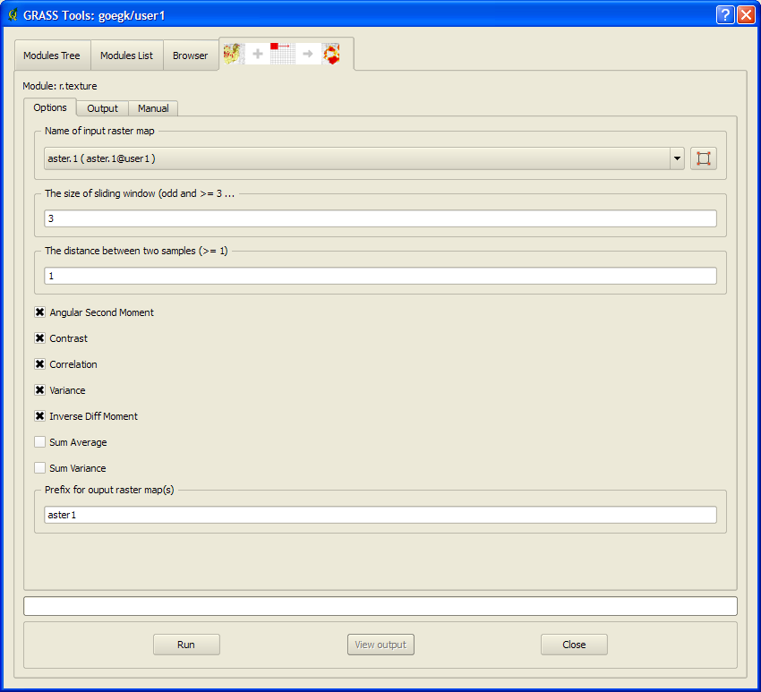
| 11:53, 1 November 2010 | Texture module.png (file) |  | 36 KB | Lburgr | (Screenshot of GRASS texture module GUI in QGIS) | 1 |
| 11:16, 1 November 2010 | Texture.png (file) |  | 69 KB | Lburgr | (Graphic describing the calculation of Haralick texture measures.) | 1 |
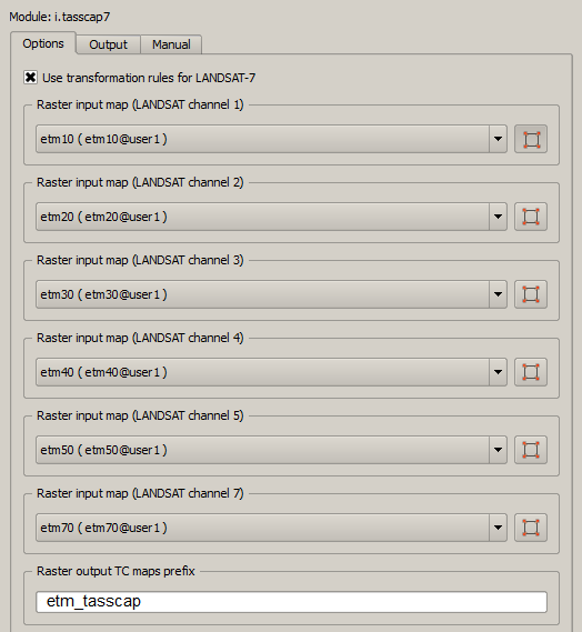
| 19:11, 27 October 2010 | Tasscap7.png (file) |  | 26 KB | Lburgr | (Screenshot of GRASS module “i.tasscap7” window in QGIS.) | 1 |
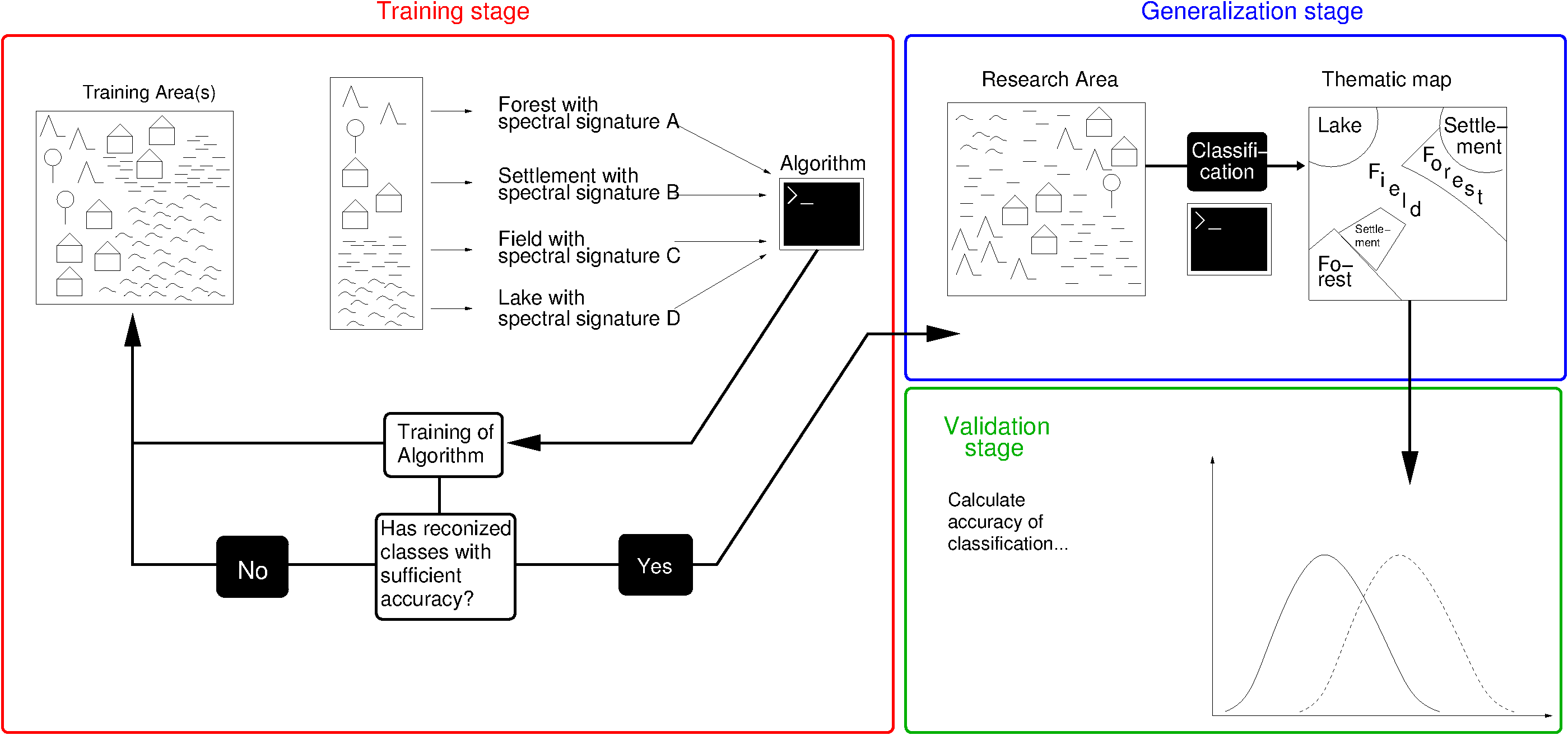
| 17:00, 11 September 2013 | Supervised Classification.png (file) |  | 64 KB | Lburgr | (* Corrected oversights (changed "spatial signature" to "spectral signature"). * Changed working step structure to fit the one in the lecture * Improved overall structure) | 4 |
| 17:14, 8 April 2011 | Setregion.png (file) |  | 697 B | Lburgr | (Screenshot of the “Set region to selected map” button in the GRASS data browser in QGIS.) | 1 |
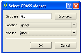
| 10:13, 18 October 2011 | Select GRASS dbase.png (file) |  | 10 KB | Lburgr | (Screenshot of QGIS "select GRASS dbase" dialog on Windows XP) | 1 |
| 17:51, 1 November 2010 | Select.png (file) |  | 1 KB | Lburgr | (Screenshot of QGIS selecting tool.) | 1 |
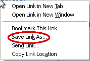
| 11:26, 11 September 2011 | Savelink winxp.png (file) |  | 3 KB | Lburgr | (Screenshot of rightclick-on-link pulldown menu in Windows XP) | 1 |
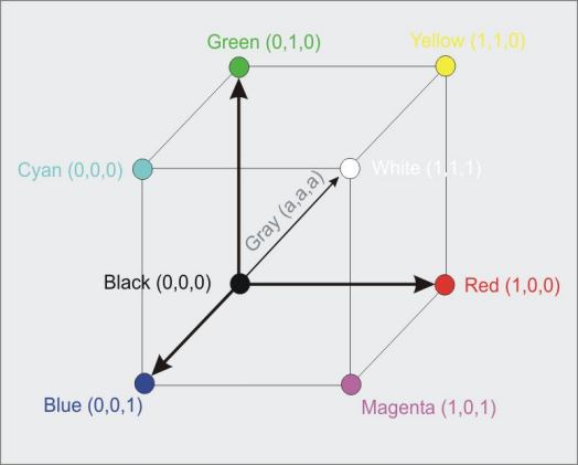
| 13:47, 26 October 2010 | Rgbcube.jpg (file) |  | 16 KB | Lburgr | (Graphic of RGB color model.) | 1 |
| 15:44, 20 October 2010 | Rgb composer.png (file) |  | 8 KB | Lburgr | (Screenshot of GRASS RGB-Composer icon) | 1 |
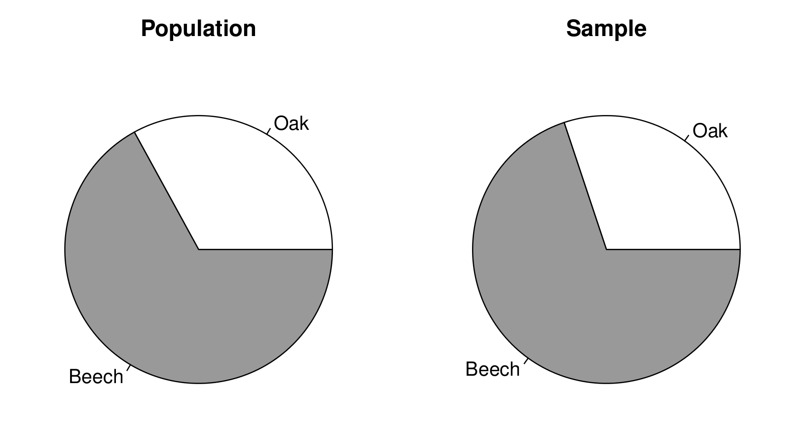
| 19:53, 8 July 2014 | Resource assessment specshares.png (file) |  | 76 KB | Lburgr | (Species shares (oak and beech) in a simulated tree population generated for the Resource assessment exercises 2014.) | 1 |
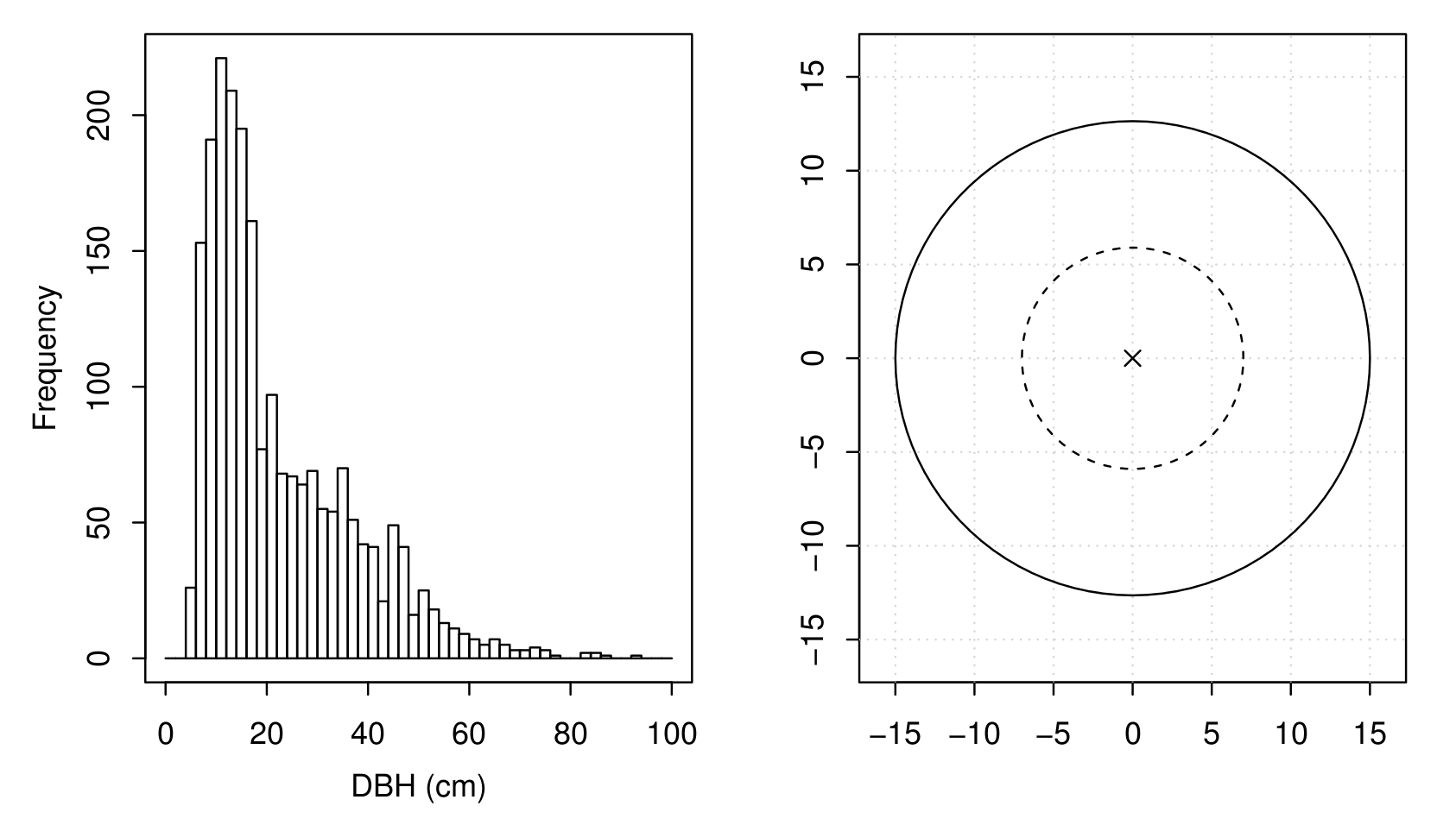
| 13:36, 23 July 2014 | Resource assessment hist and nested plot.png (file) |  | 108 KB | Lburgr | (Histogram of DBHs of a stand simulated for the Resource assessment exercises and nested sample plot.) | 1 |
| 09:03, 10 May 2014 | Resource assessment exercises trees.png (file) |  | 629 KB | Lburgr | (File was still to large. Seems I needed a crash course on dpi values for web use.) | 3 |
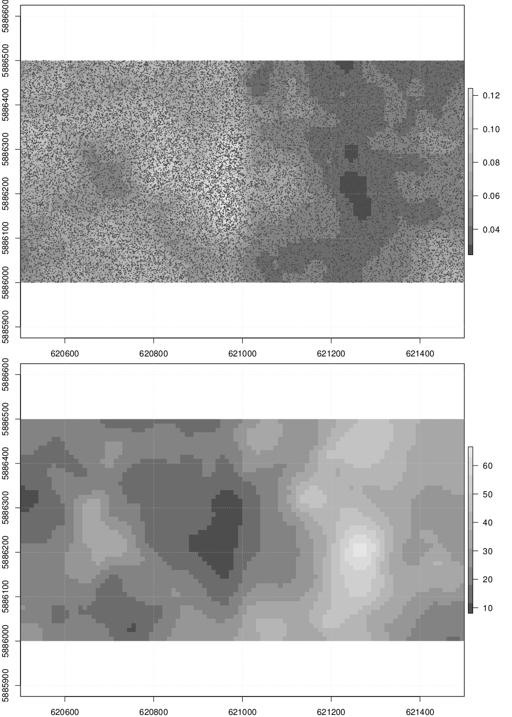
| 08:30, 10 May 2014 | Resource Assessment Exercises trees.pdf (file) | 644 KB | Lburgr | (Visualization of the example data set for the Resource assessment exercises 2014 showing the spatial distribution of trees (top) and the spatial distributin of DBH values in the forest (bottom).) | 1 | |
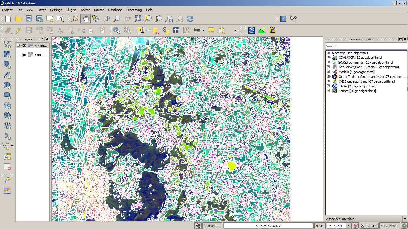
| 18:05, 19 February 2014 | RemSens Exercise10 03.jpg (file) |  | 609 KB | Lburgr | (Screenshot of a QGIS 2.0 session with vector map generated from raster segmentation in Monteverdi. Part of the QGIS Tutorial 2013/14.) | 1 |
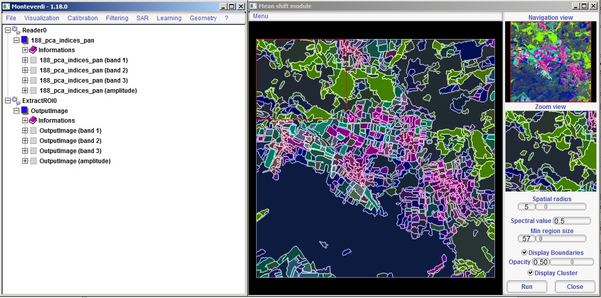
| 18:02, 19 February 2014 | RemSens Exercise10 01.jpg (file) |  | 281 KB | Lburgr | (Screenshot of the Monteverdi Mean shift module with Land cover index maps loaded. Part of the QGIS Tutorial 2013/14.) | 1 |
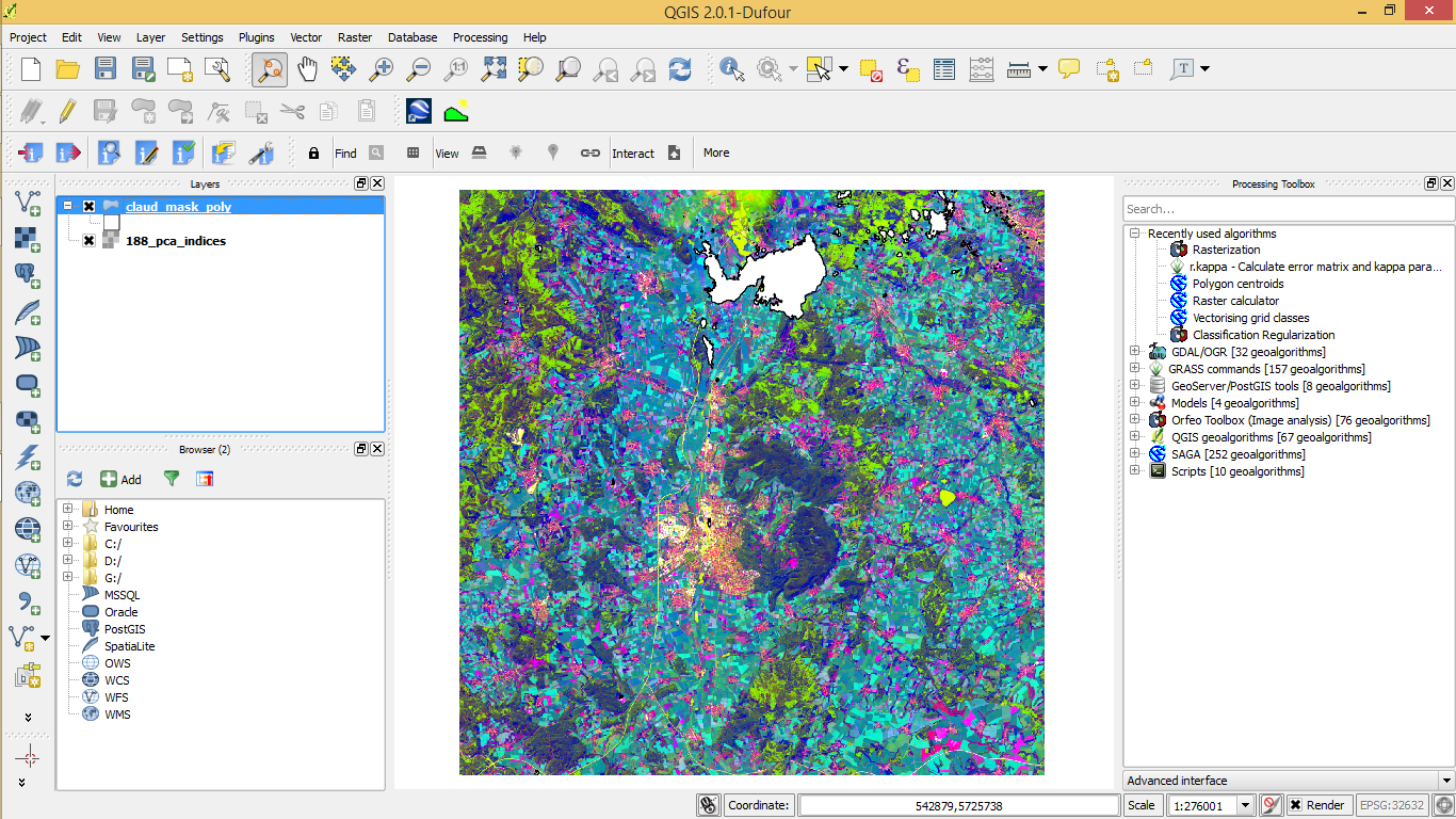
| 17:21, 18 February 2014 | RemSens Exercise09 10.png (file) |  | 940 KB | Lburgr | (Screenshot of a QGIS 2.0 session with pca indices map generated from LANDSAT data and a vector layer representing cloud cover, generated with the SAGA ''Vectorising Grid Classes'' algorithm.) | 1 |
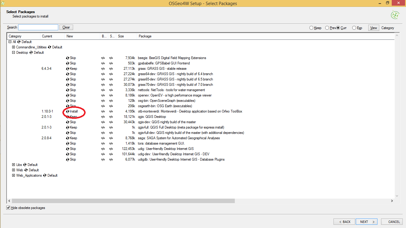
| 16:51, 18 February 2014 | RemSens Exercise09 05.png (file) |  | 69 KB | Lburgr | (Dialogue for installing software via the OSGeo4W installer with monteverdi highlighted. Part of QGIS Tutorial 2013/14.) | 1 |
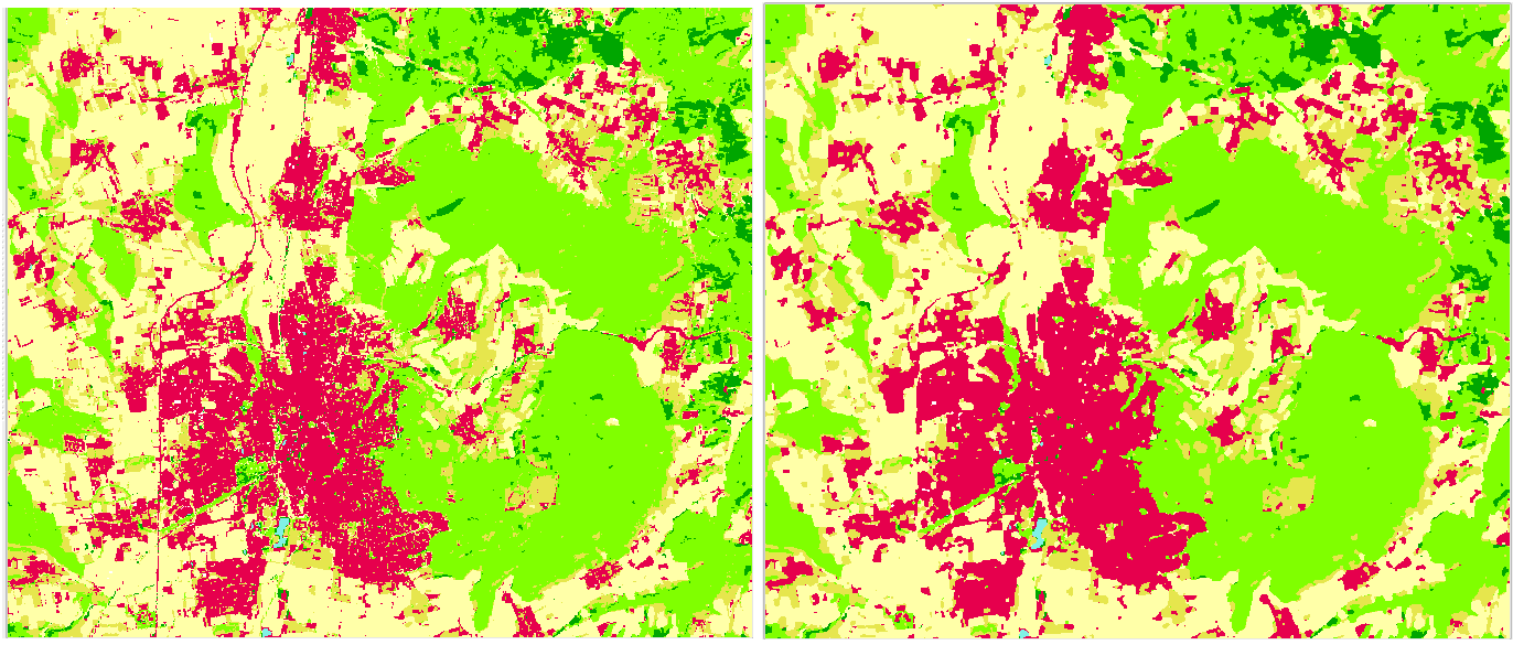
| 16:46, 18 February 2014 | RemSens Exercise09 04.png (file) |  | 3.07 MB | Lburgr | (Land cover map before and after enhancement by the Orfeo Toolbox ''Classification Regularization'' plugin. Part of the QGIS Tutorial 2013/14.) | 1 |
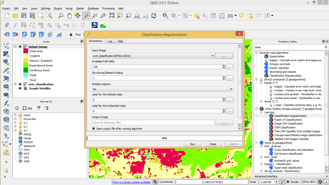
| 16:36, 18 February 2014 | RemSens Exercise09 03.png (file) |  | 187 KB | Lburgr | (Classification Regularization of the Orfeo Toolbox loaded in QGIS 2.0 via SEXTANTE. Part of the QGIS Tutorial 2013/14.) | 1 |
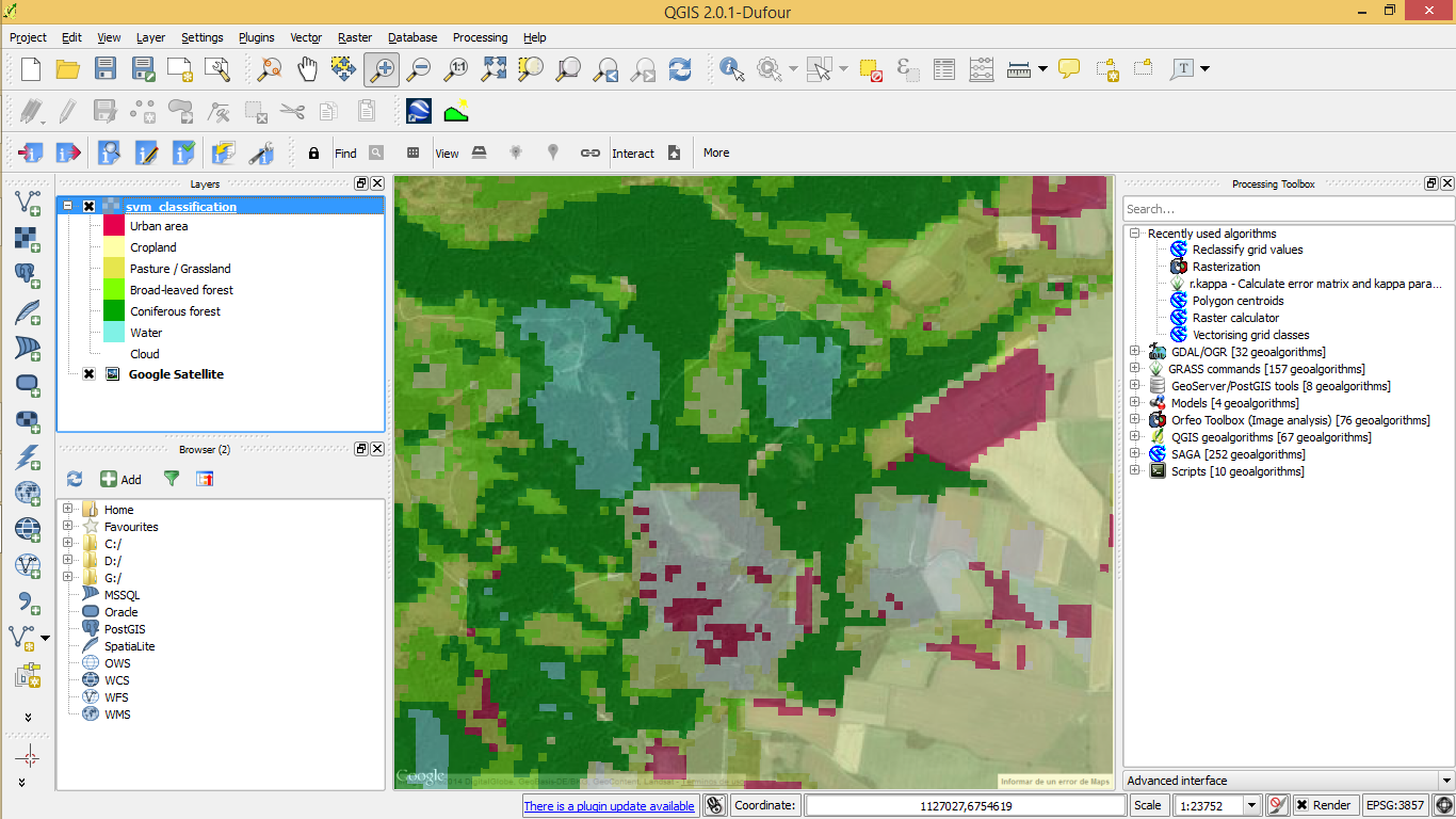
| 16:34, 18 February 2014 | RemSens Exercise09 02.png (file) |  | 584 KB | Lburgr | (Land cover map in QGIS 2.0 with underlying Google satellite layer, zoomend in to a scale of 1:2375 in order to check for classification errors. Part of QGIS Tutorial 2013/14. ) | 1 |
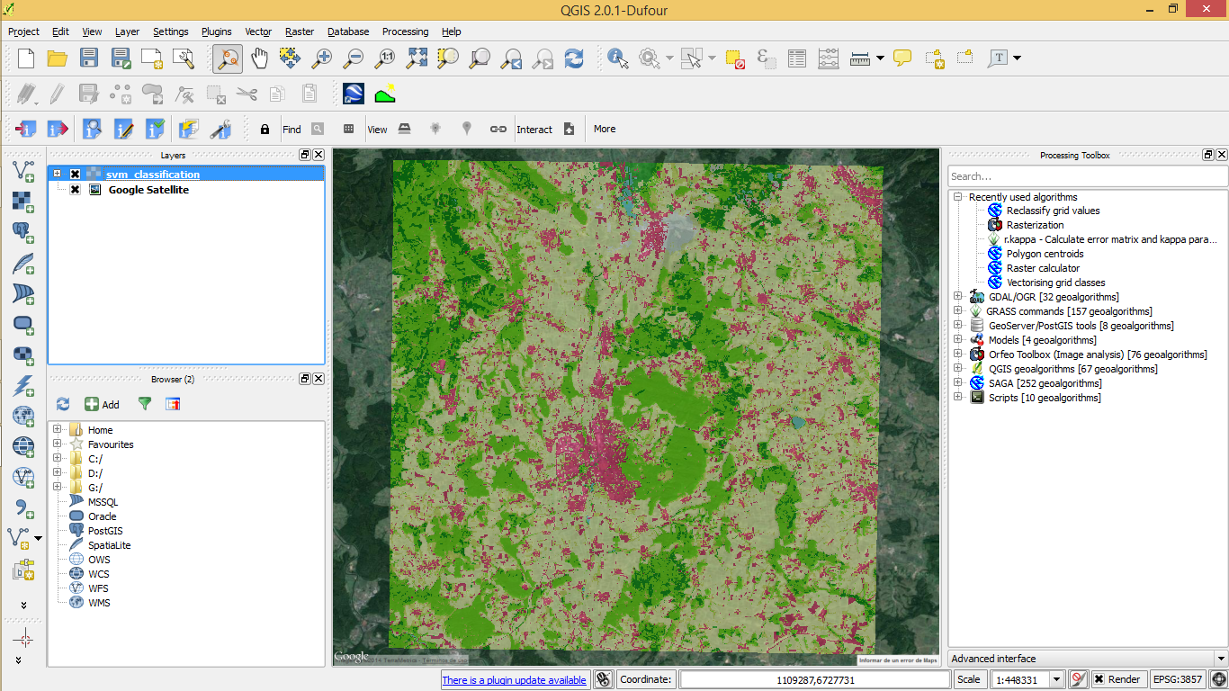
| 16:32, 18 February 2014 | RemSens Exercise09 01.png (file) |  | 873 KB | Lburgr | (Land cover map in QGIS 2.0 with underlying google satellite layer. Part of the QGIS Tutorial 2013/14.) | 1 |
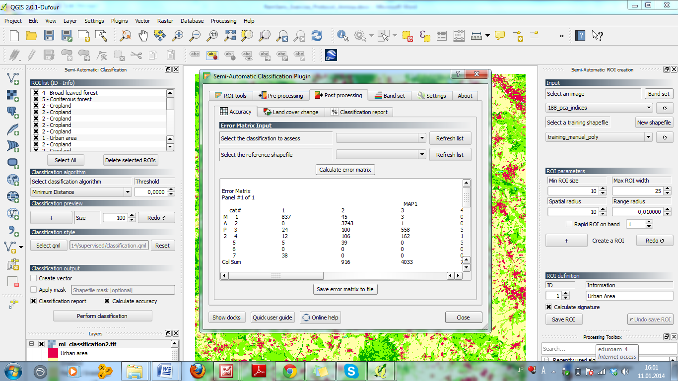
| 18:37, 17 February 2014 | RemSens Exercise08 05.png (file) |  | 306 KB | Lburgr | (Accuracy tap of the ''Semi-Automatic Classification Plugin'' in QGIS 2.0. Part of the QGIS Tutorial 2013/14.) | 1 |
| 18:36, 17 February 2014 | RemSens Exercise08 04.png (file) |  | 407 KB | Lburgr | (Menus of the ''Semi-Automatic Classification'' plugin in QGIS 2.0 with output raster map. Part of the QGIS Tutorial 2013/14. ) | 1 |
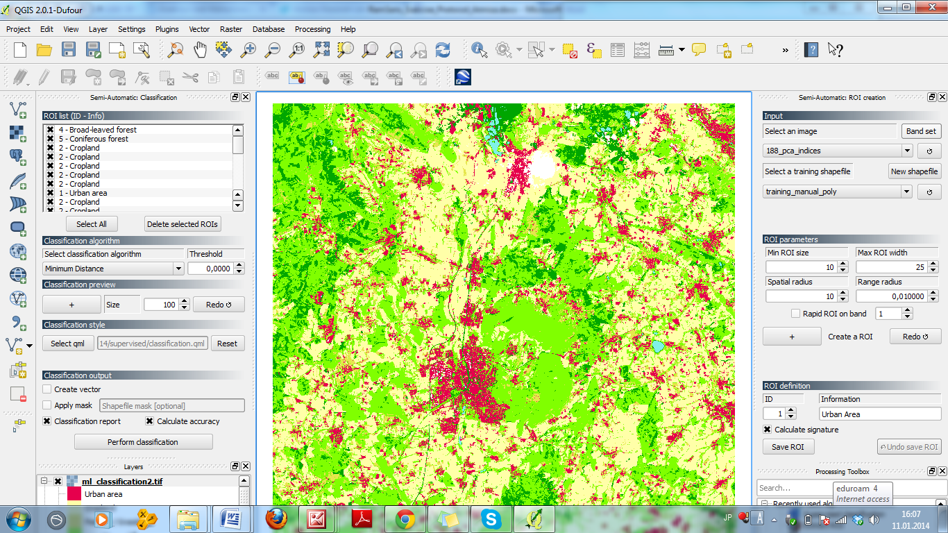
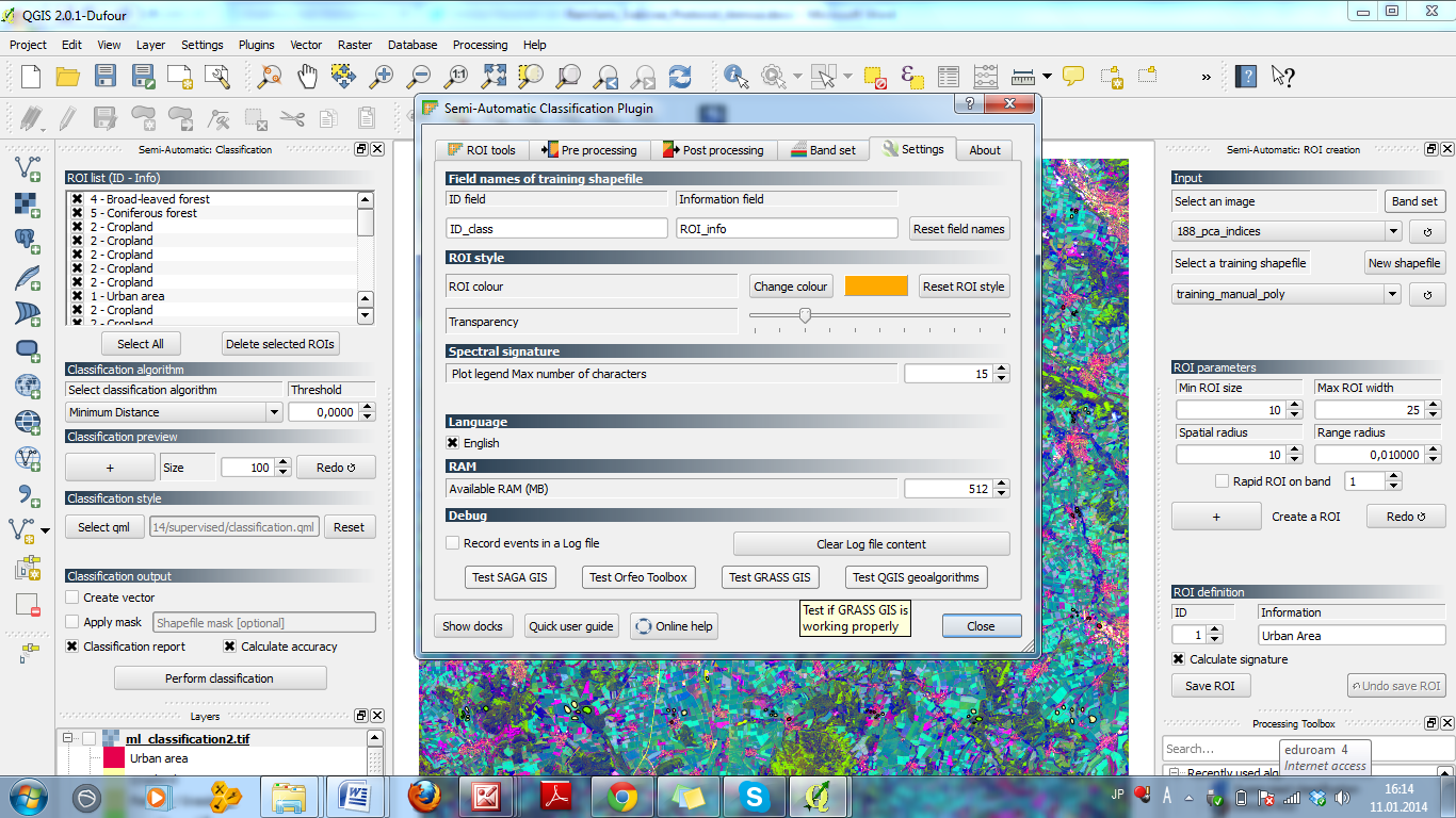
| 18:35, 17 February 2014 | RemSens Exercise08 02.png (file) |  | 1.18 MB | Lburgr | (Dialogues of the ''Semi-Automatic Classification Plugin'' in QGIS 2.0 with loaded land cover map. Part of the QGIS Tutorial 2013/14.) | 1 |
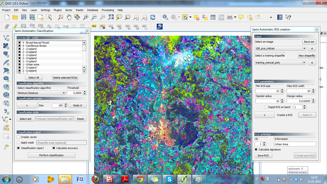
| 18:33, 17 February 2014 | RemSens Exercise08 01.png (file) |  | 551 KB | Lburgr | (Screenshot of the ''Semi-Automatic Classification'' plugin in QGIS 2.0. Part of the QGIS Tutorial 2013/14.) | 1 |
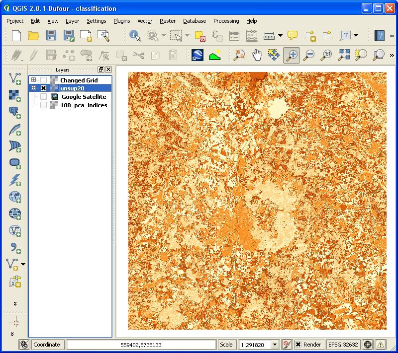
| 12:21, 17 February 2014 | RemSens Exercise07 03.png (file) |  | 223 KB | Lburgr | (Landcover map produced by unsupervised K-Means image classification plugin from the Orfeo-Toolbox in QGIS, 2.0 displayed in discrete colors. Part of the QGIS Tutorial 2013/14.) | 1 |
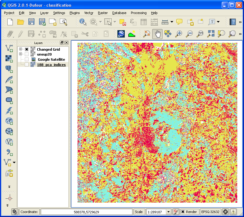
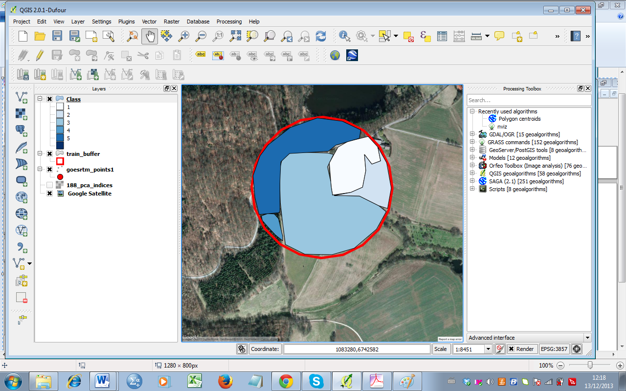
| 12:19, 17 February 2014 | RemSens Exercise07 02.png (file) |  | 375 KB | Lburgr | (Landcover map produced by the Orfeo-Toolbox unsupervised K-Means image classification plugin in QGIS 2.0. Part of the QGIS Tutorial 2013/14) | 1 |
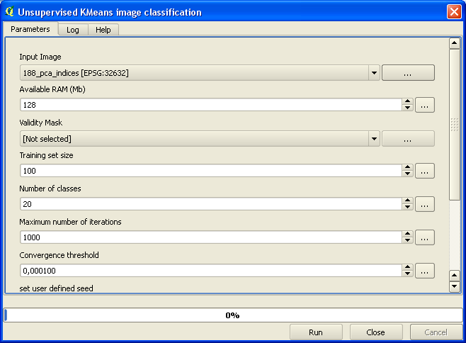
| 12:18, 17 February 2014 | RemSens Exercise07 01.png (file) |  | 25 KB | Lburgr | (Screenshot of the Orfeo-Toolbox unsupervised KMeans image classification plugin dialogue in QGIS 2.0. Part of QGIS Tutorial 2013/14.) | 1 |
| 19:11, 24 January 2014 | RemSens Exercise06 05.png (file) |  | 648 KB | Lburgr | (Screenshot of QGIS 2.0 session with Google satellite layer and a digitized sample point with landscape classes.) | 1 |
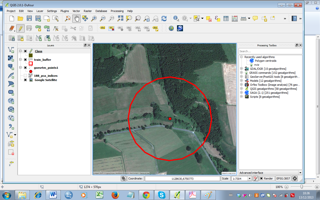
| 19:08, 24 January 2014 | RemSens Exercise06 04.png (file) |  | 712 KB | Lburgr | (Screenshot of QGIS 2.0 session with loaded Google satellite layer and sample point for landscape classification.) | 1 |
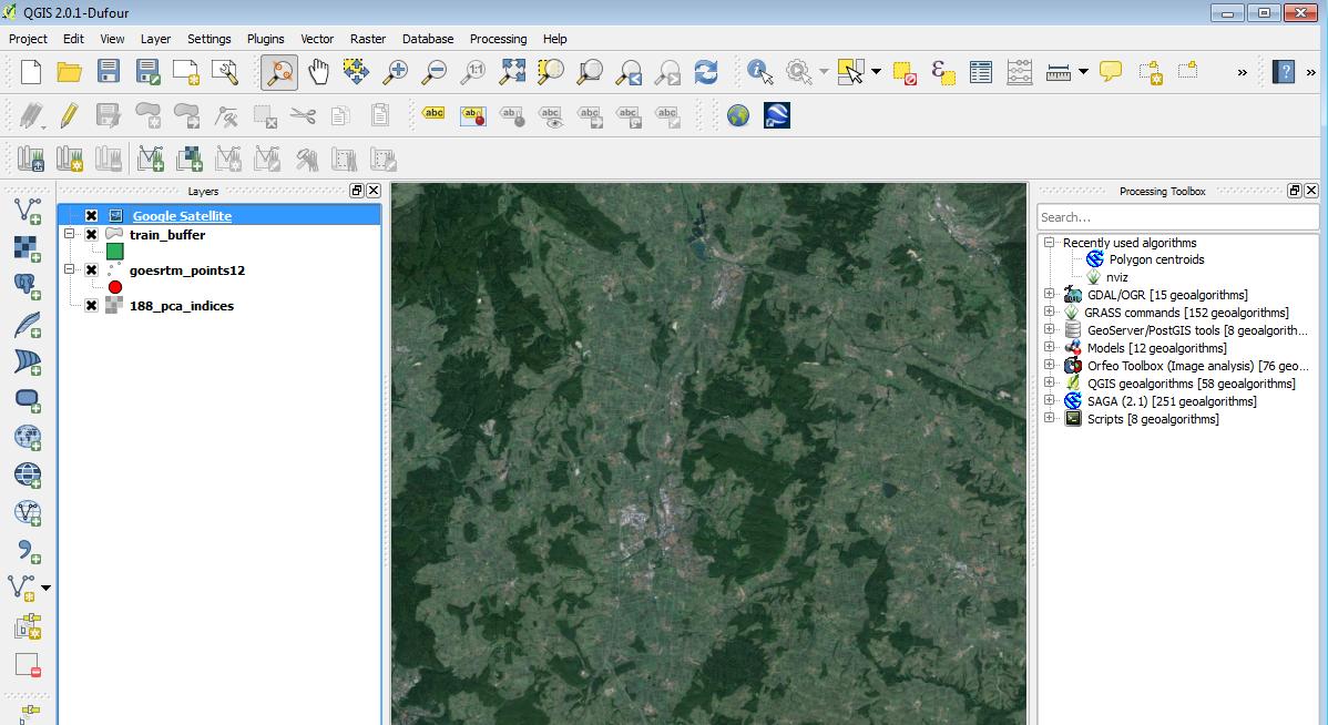
| 19:07, 24 January 2014 | RemSens Exercise06 03.png (file) |  | 595 KB | Lburgr | (Screenshot of QGIS 2.0 session with Google sattelite layer of the vicinity of Göttingen, loaded via the ''Open layers'' plugin.) | 1 |
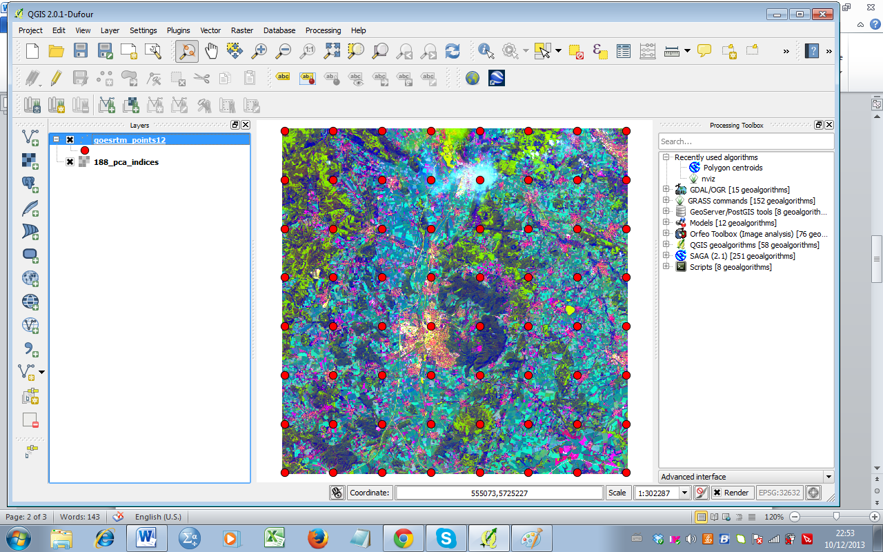
| 19:06, 24 January 2014 | RemSens Exercise06 02.png (file) |  | 671 KB | Lburgr | (Screenshot of QGIS 2.0 session with loaded landscape classification map and buffered sample points generated with the ''Regular points'' tool.) | 1 |
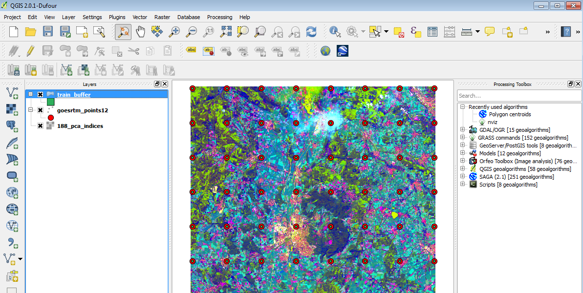
| 19:04, 24 January 2014 | RemSens Exercise06 01.png (file) |  | 829 KB | Lburgr | (Screenshot of QGIS 2.0 session with loaded landscape classification map and sample points added with the ''Regular points'' tool.) | 1 |
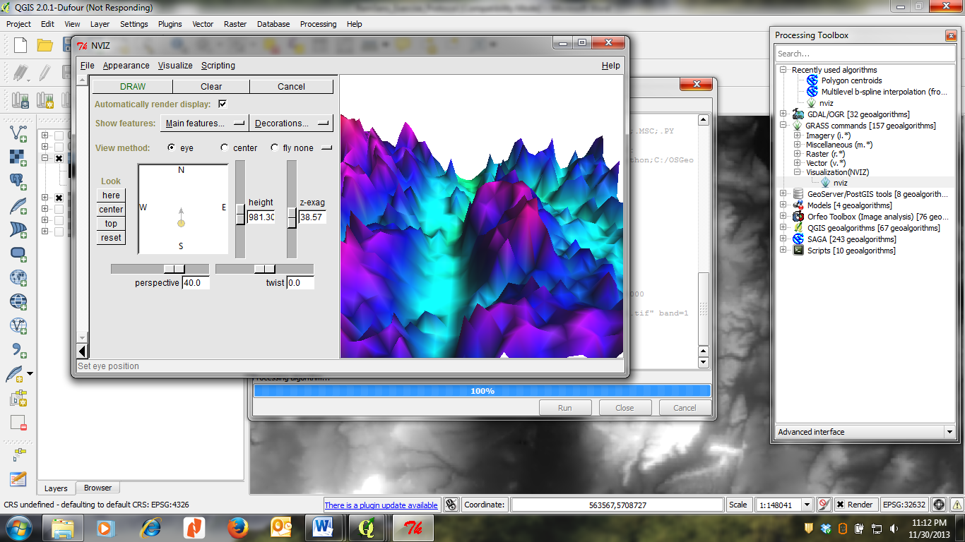
| 19:52, 25 January 2014 | RemSens Exercise05 06.png (file) |  | 435 KB | Lburgr | (Screenshot of QGIS session with output window of the GRASS NVIZ plugin.) | 1 |
| 19:51, 25 January 2014 | RemSens Exercise05 05.png (file) |  | 332 KB | Lburgr | (Screenshot of a QGIS 2.0 session with open NVIZ menu loaded via the GRASS plugin. ) | 1 |
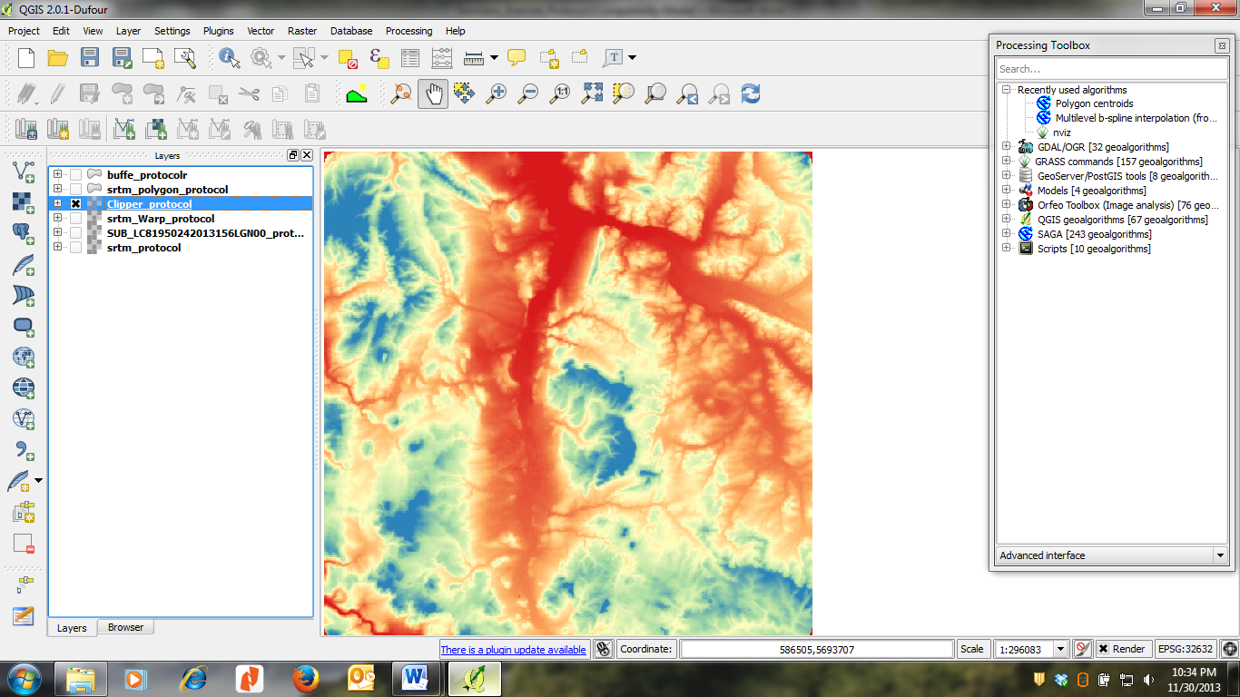
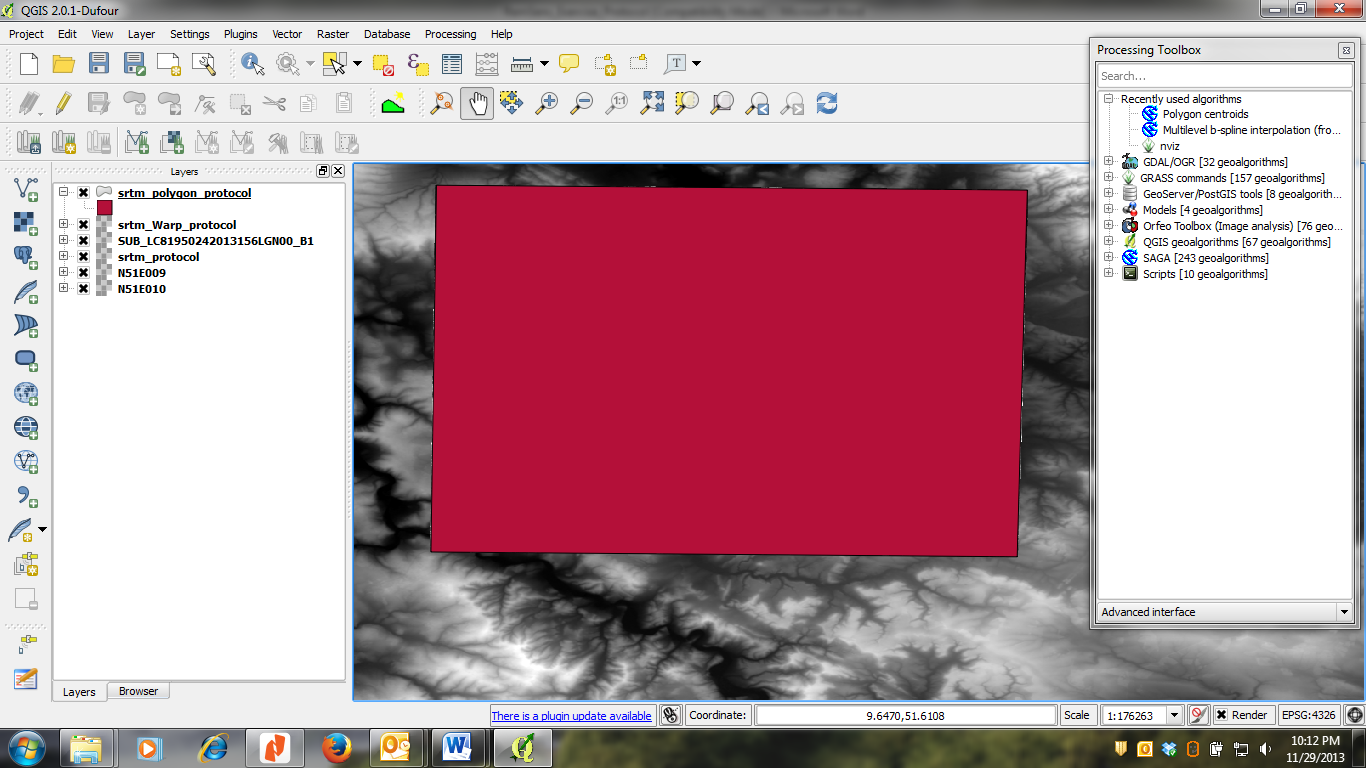
| 16:42, 21 January 2014 | RemSens Exercise05 04.png (file) |  | 561 KB | Lburgr | (QGIS 2.0 session on windows with DEM raster displayed in pseudocolor.) | 1 |
| 16:41, 21 January 2014 | RemSens Exercise05 03.png (file) |  | 357 KB | Lburgr | (QGIS 2.0 session in Windows with result of the ''polygon from layer extent'' tool.) | 1 |
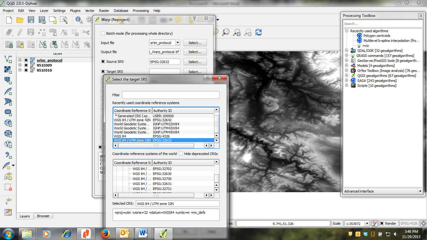
| 11:56, 21 January 2014 | RemSens Exercise05 02.png (file) |  | 418 KB | Lburgr | (Screenshot of a QGIS 2.0 session with raster warp dialogue.) | 1 |
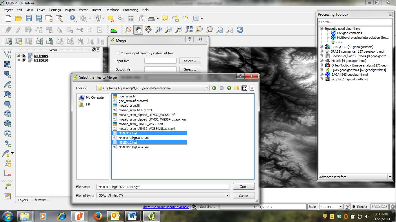
| 10:14, 21 January 2014 | RemSens Exercise05 01.png (file) |  | 376 KB | Lburgr | (Screenshot of a QGIS 2.0 session with dialogue for the raster merge tool and file browser.) | 1 |
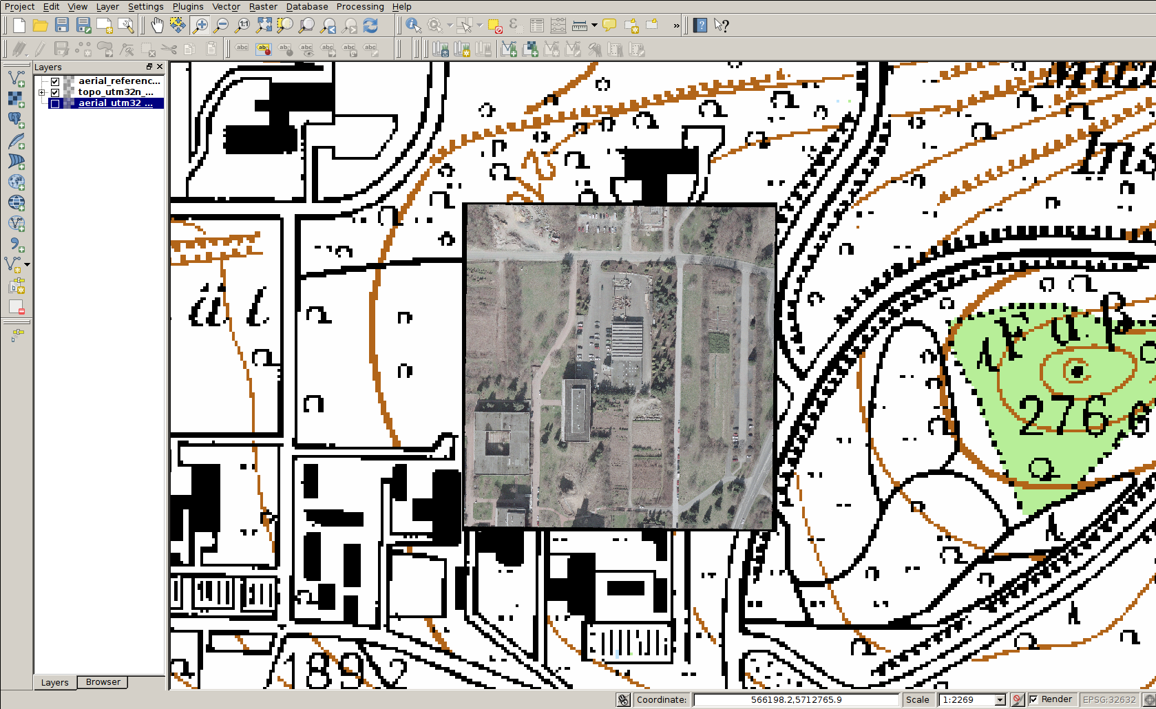
| 12:44, 10 December 2013 | RemSens Exercise03 9.png (file) |  | 615 KB | Lburgr | (QGIS 2.0 with a georeferenced aerial photograph of the faculty for forestry, Göttingen, with underlying topographic map.) | 1 |
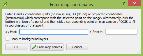
| 12:32, 10 December 2013 | RemSens Exercise03 7.png (file) |  | 373 KB | Lburgr | (Ground control point coordinate prompt in the QGIS 2.0 georeferencing dialogue. Part of Exercise 03b: Georeferencing of the QGIS tutorial 2013/14.) | 1 |
First page |
Previous page |
 Next page |
Last page |