File list
This special page shows all uploaded files. When filtered by user, only files where that user uploaded the most recent version of the file are shown.
| Name | Thumbnail | Size | User | Description | Versions | |
|---|---|---|---|---|---|---|
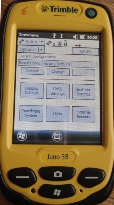
| 11:53, 26 November 2013 | Trimble Setup.jpg (file) |  | 96 KB | Lburgr | (Image of the ''Trimble Juno 3B'' GPS receiver with open setup menu.) | 1 |
| 20:47, 16 November 2013 | QGIS RelPath.png (file) | 14 KB | Lburgr | (Screenshot of a section of a QGIS project file opened in gVim, with stored relative path to a shapefile.) | 1 | |
| 20:42, 16 November 2013 | QGIS AbsPath.png (file) | 19 KB | Lburgr | (Screenshot of an absolute path to a layer stored in a QGIS 2.0 project file.) | 1 | |
| 16:39, 16 November 2013 | QGIS 2.0 SaveEdit.png (file) |  | 755 B | Lburgr | (Screenshot of the ''save'' icon in QGIS 2.0 editing mode.) | 1 |
| 16:29, 16 November 2013 | QGIS 2.0 Edit.png (file) |  | 840 B | Lburgr | (Screenshot of QGIS 2.0 ''Toggle edit'' icon.) | 1 |
| 15:53, 16 November 2013 | QGIS 2.0 GPSTools.png (file) |  | 565 B | Lburgr | (Screenshot of the QGIS GPSTools plugin icon.) | 1 |
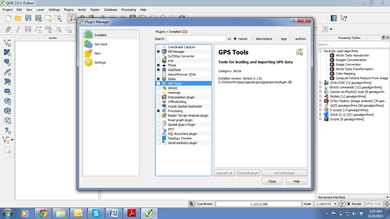
| 15:16, 16 November 2013 | RemSens Exercise02 1.png (file) |  | 181 KB | Lburgr | (QGIS Screenshot with opened plugin manager. Part of QGIS Tutorial 2013/14 exercise 02.) | 1 |
| 14:59, 11 November 2013 | QGIS 2.0 addvect.png (file) |  | 1 KB | Lburgr | (Screenshot of "Add vector layer" icon in QGIS 2.0) | 1 |
| 20:17, 9 November 2013 | QGIS 2.0 zoomtolayer.png (file) |  | 993 B | Lburgr | (Icon for zoom to layer function in QGIS 2.0.) | 1 |
| 20:16, 9 November 2013 | QGIS 2.0 zoominout.png (file) |  | 1 KB | Lburgr | (Icons for zooming in and out in QGIS 2.0.) | 1 |
| 20:12, 9 November 2013 | QGIS 2.0 addrast.png (file) |  | 509 B | Lburgr | (Screenshot of QGIS 2.0 add raster layer icon.) | 1 |
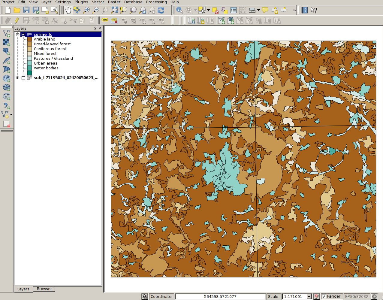
| 20:01, 9 November 2013 | RemSens Exercise01 4.png (file) |  | 630 KB | Lburgr | (CORINE landcover map for Göttingen and vicinity in QGIS. Part of exercise one of the QGIS tutorial 2013/14.) | 1 |
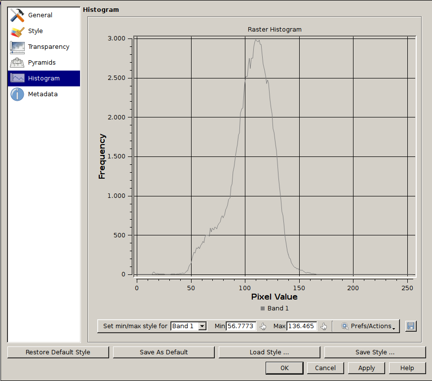
| 19:09, 9 November 2013 | RemSens Exercise01 2.png (file) |  | 56 KB | Lburgr | (Screenshot of a histogram of pixel values of a ''landsat'' map, generated in the course of QGIS Tutorial 2013/14, Exercise 01.) | 1 |
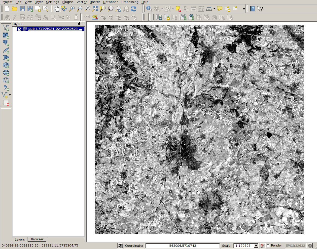
| 12:15, 9 November 2013 | RemSens Exercise01 1.png (file) |  | 951 KB | Lburgr | (Screenshot for Exercise01 of the QGIS Tutorial 2013/14, after loading a ''landsat'' map into QGIS.) | 1 |
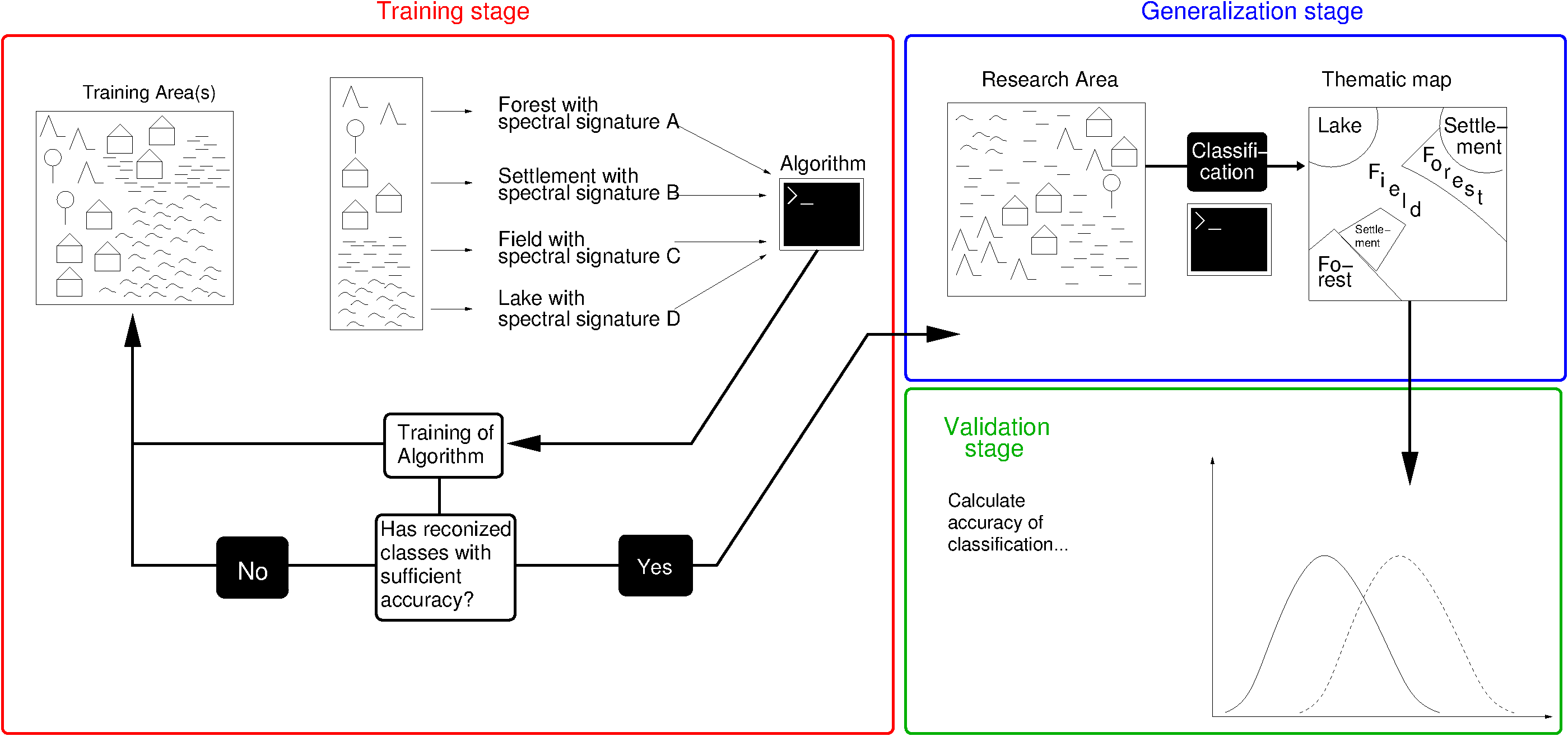
| 17:00, 11 September 2013 | Supervised Classification.png (file) |  | 64 KB | Lburgr | (* Corrected oversights (changed "spatial signature" to "spectral signature"). * Changed working step structure to fit the one in the lecture * Improved overall structure) | 4 |
| 15:36, 3 September 2013 | Hierarchical Clustering.png (file) |  | 52 KB | Lburgr | (An example R plot to illustrate hierarchical clustering, containing fictional data points and a dendrogram. R Code: ## Some fictional satellite brightness values: rm(list=ls()) set.seed(23) # just change the seed to see different outcomes! da...) | 1 |
| 12:05, 3 August 2013 | Iterative Clustering.png (file) |  | 113 KB | Lburgr | (Added main title.) | 2 |
| 16:14, 25 June 2013 | Landsat corr.png (file) |  | 78 KB | Lburgr | (Correlation of LANDSAT bands 4 and 5, based on the input data provided for the exercises of the lecture "Remote sensing image processing with open source GIS". A link to the data will be provided as soon as it is downloadable. Code: library(rgdal) ...) | 1 |
| 12:01, 21 June 2013 | Landsat corr fake.png (file) |  | 2.45 MB | Lburgr | (A plot of fictional correlation between brightness values of two satellite bands. Generated in R and edited with GIMP. Code: -------------------------------------------------------------------- data <- data.frame(band.4=c(rnorm(500, mean=100, sd=20), ...) | 1 |
| 10:23, 18 October 2011 | Manu3.jpg (file) |  | 78 KB | Lburgr | (Newer version (QGIS 1.7) under WinXP with highlighted browser tab and "Add to canvas" icon) | 2 |
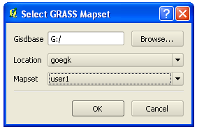
| 10:13, 18 October 2011 | Select GRASS dbase.png (file) |  | 10 KB | Lburgr | (Screenshot of QGIS "select GRASS dbase" dialog on Windows XP) | 1 |
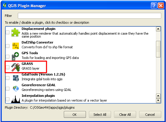
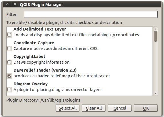
| 09:55, 18 October 2011 | Plugin Manager GRASS.png (file) |  | 25 KB | Lburgr | (Screenshot of QGIS plugin manager with highlighted GRASS plugin checkbox) | 1 |
| 09:48, 18 October 2011 | Plugins Menu.png (file) |  | 5 KB | Lburgr | (Screenshot of QGIS “Plugins” menu on Windows XP) | 1 |
| 12:36, 16 October 2011 | Map navigation.png (file) | 27 KB | Lburgr | (Reverted to version as of 08:36, 16 October 2011 - uploaded wrong file by accident) | 4 | |
| 09:19, 16 October 2011 | Add vector.png (file) | 18 KB | Lburgr | (Screenshot of QGIS toolbars with marked „add vector“ icon) | 1 | |
| 14:57, 11 September 2011 | Projectproperties button QGIS 1.7 winxp.png (file) |  | 7 KB | Lburgr | (A screenshot of the project properties button in QGIS 1.7 under Windows XP.) | 1 |
| 14:35, 11 September 2011 | Languagetab QGis 1.7 ger winxp.png (file) |  | 25 KB | Lburgr | (Screenshot of german QGIS 1.7 options menu with highlighted language tab in Windows XP) | 1 |
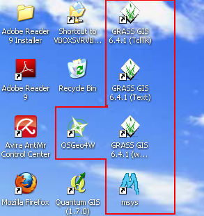
| 11:56, 11 September 2011 | QGIS Icons winxp.png (file) | 87 KB | Lburgr | (Screenshot of QGis Desktop Icons after installing with OSGeo4W under Windows XP) | 1 | |
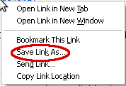
| 11:26, 11 September 2011 | Savelink winxp.png (file) |  | 3 KB | Lburgr | (Screenshot of rightclick-on-link pulldown menu in Windows XP) | 1 |
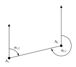
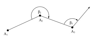
| 17:33, 15 May 2011 | Dir angle.jpg (file) |  | 4 KB | Lburgr | (A Sketch displaying the principle of the azimuth/direction angle) | 1 |
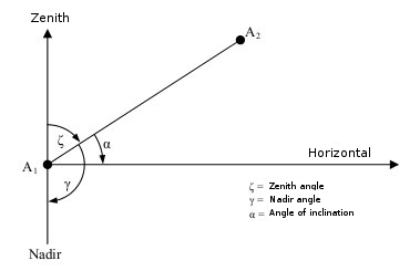
| 17:19, 15 May 2011 | Elev angle.jpg (file) |  | 12 KB | Lburgr | (Changed labels to english) | 2 |
| 17:02, 15 May 2011 | Ref angle.jpg (file) |  | 5 KB | Lburgr | (A sketch displaying the principle of the angle of refraction) | 1 |
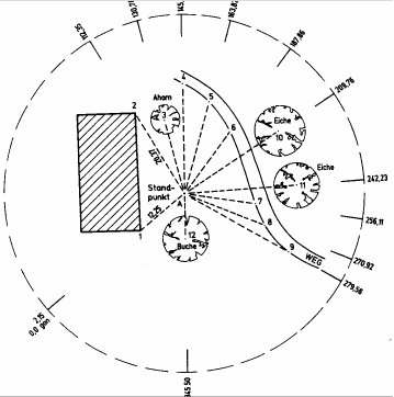
| 16:12, 15 May 2011 | Polarverfahren.jpg (file) |  | 46 KB | Lburgr | (A sketch showing the principle of the polar coordinate method. Taken from: Kleinn, Dr. C. Skriptum zur Vorlesung „Einführung in die Vermessungslehre“ für Studierende der Forstwissenschaften. Georg August Universität Göttingen, 2009. ) | 1 |
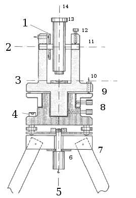
| 13:43, 1 May 2011 | Theodolit.jpg (file) |  | 36 KB | Lburgr | (Sketch of a theodolite with numbers indicating the functional parts. 1: Vertical circle. 2: Reading for vertical circle. 3: Spirit level axis. 4: Bulls eye spirit level. 5: Plumb-bob. 6: Fixation screw. 7: Tripod. 8: Clamps. 9: Horizontal circle. 10: Read) | 1 |
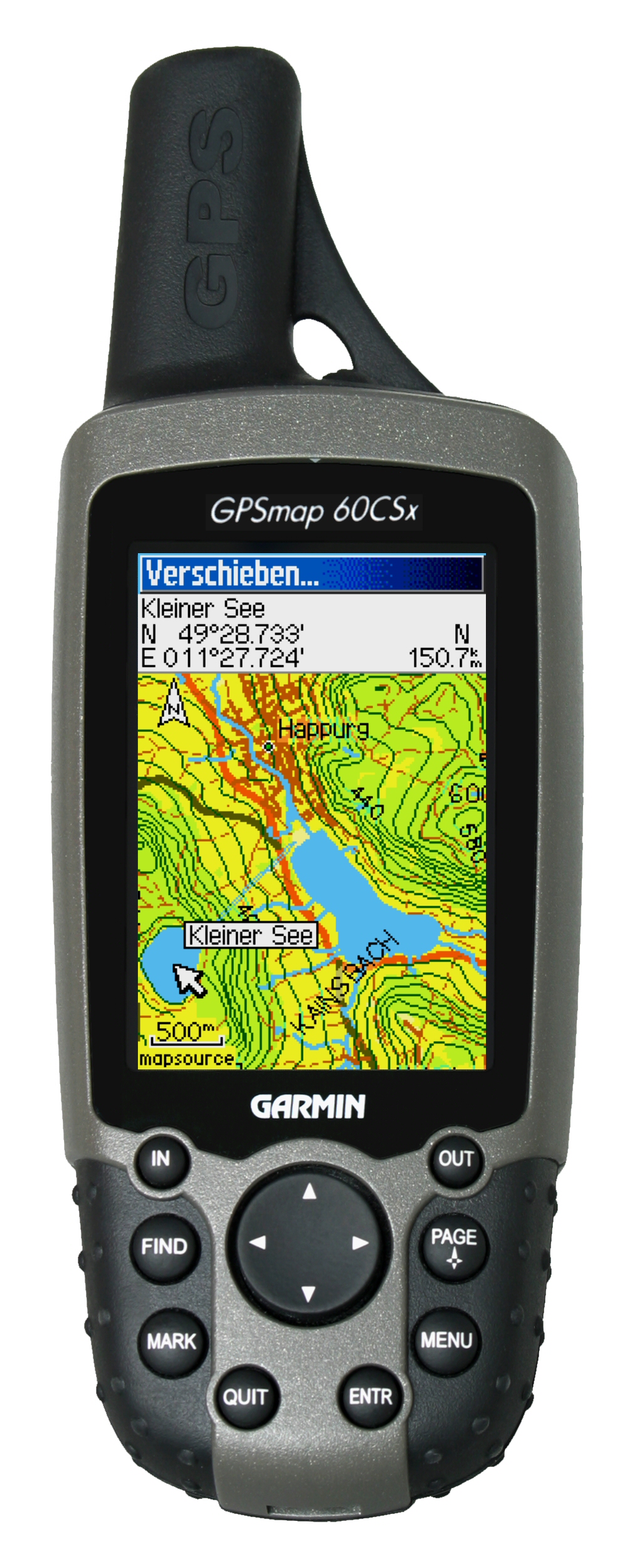
| 16:11, 23 April 2011 | GPSMAP60CSx-2-Topo.jpg (file) |  | 1.02 MB | Lburgr | (An image of the Garmin GPSmap 60CSx device. The file was taken from garmin.com, is owned by garmin and is licensed under the Creative Commons lincense. It is allowed to copy, publish and modify the file according to the [[wi) | 1 |
| 15:46, 23 April 2011 | Garmin add waypoint.png (file) |  | 56 KB | Lburgr | (An image of the Garmin GPS receivers main menu display with text explaining its components.) | 1 |
| 15:44, 23 April 2011 | Garmin main.png (file) |  | 6 KB | Lburgr | (An image of the Garmin GPS receivers main menu display.) | 1 |
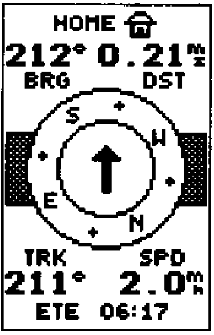
| 15:36, 23 April 2011 | Garmin navigation.png (file) |  | 6 KB | Lburgr | (A screenshot of the Garmin GPS receivers navigation display) | 1 |
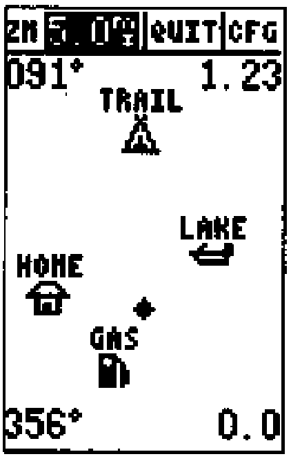
| 12:40, 23 April 2011 | Garmin map.png (file) |  | 5 KB | Lburgr | (An image of the Garmin GPS receivers map display) | 1 |
| 12:15, 23 April 2011 | Garmin position.png (file) |  | 6 KB | Lburgr | (An image of the Garmin GPS receivers position display) | 1 |
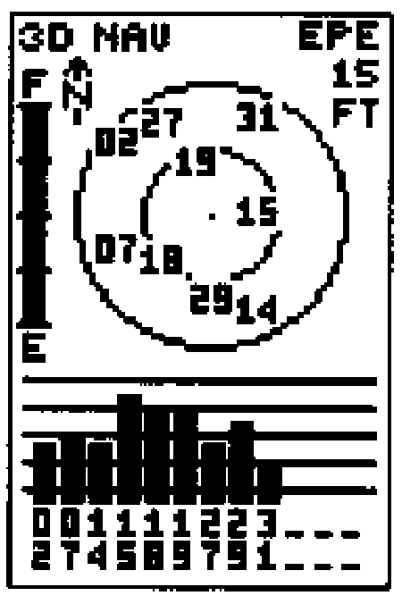
| 11:51, 23 April 2011 | Garmin satellite.png (file) |  | 6 KB | Lburgr | (An image of the Garmin GPS receivers satellite display) | 1 |
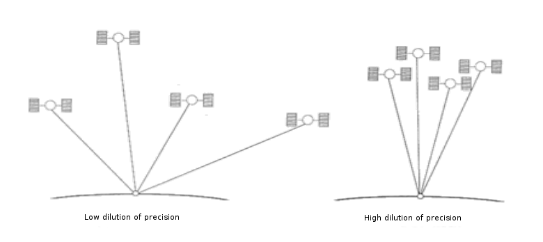
| 16:47, 15 April 2011 | Dilution of precision.png (file) |  | 40 KB | Lburgr | (An image of the dilution of precision (DOP) depending on the position of satellites on the horizon during GPS positioning.) | 1 |
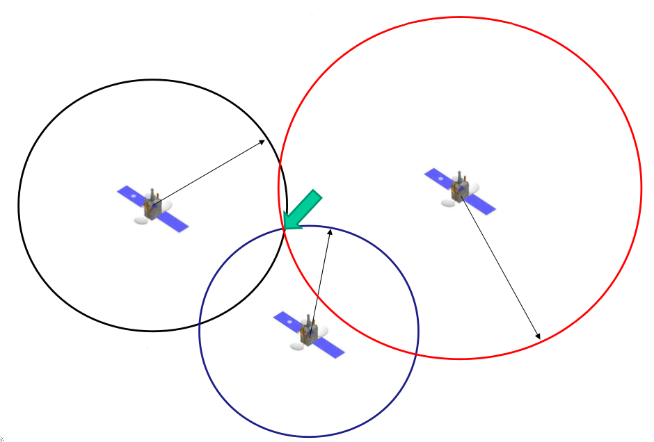
| 18:27, 14 April 2011 | GPS principle.png (file) |  | 85 KB | Lburgr | (The principle of GPS positionig with three satellites.) | 1 |
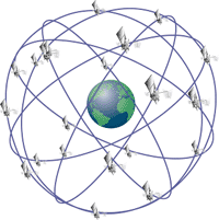
| 17:04, 14 April 2011 | GPS-24 satellite.png (file) |  | 10 KB | Lburgr | (Configuration of GPS satellites. This picture belongs to the public domain. For information on the original upload see the [http://commons.wikimedia.org/wiki/File:GPS-24_satellite.png?uselang=de]) | 1 |
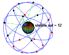
| 16:49, 14 April 2011 | ConstellationGPS.gif (file) |  | 485 KB | Lburgr | (A simulation of the original design of the GPS space segment, with 24 GPS satellites (4 satellites in each of 6 orbits), showing the evolution of the number of visible satellites from a fixed point (45ºN) on earth (considering "visibility" as having dire) | 1 |
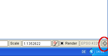
| 17:14, 8 April 2011 | Setregion.png (file) |  | 697 B | Lburgr | (Screenshot of the “Set region to selected map” button in the GRASS data browser in QGIS.) | 1 |
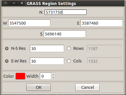
| 15:38, 8 April 2011 | Region settings.png (file) |  | 29 KB | Lburgr | (Screenshot of the “region settings” dialog from the GRASS plugin in QGIS.) | 1 |
| 09:33, 8 April 2011 | Region display button.png (file) |  | 5 KB | Lburgr | (The “Display current GRASS region” button of the GRASS toolbar in QGIS) | 1 |
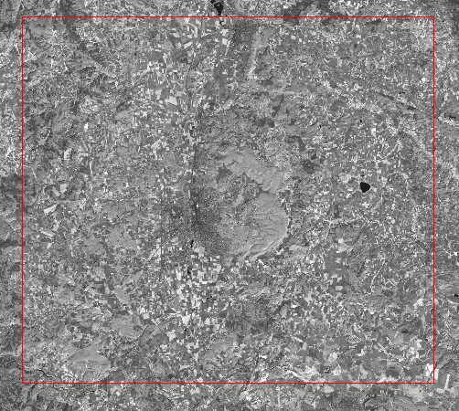
| 09:30, 8 April 2011 | Region display.png (file) |  | 427 KB | Lburgr | (An example of the GRASS region displayed in QGIS) | 1 |
| 17:06, 7 April 2011 | Plugin manager.png (file) |  | 53 KB | Lburgr | (A closeup view of the plugin manager, more suitable for use in articles.) | 2 |
First page |
Previous page |
Next page |
Last page |