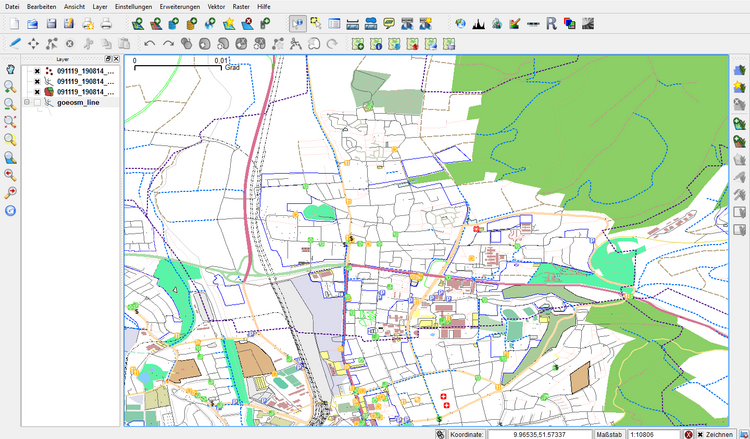
OpenStreet Map layer
| Line 1: | Line 1: | ||
| − | |||
| − | |||
OpenStreetMap creates and provides free geographic data such as street maps to anyone | OpenStreetMap creates and provides free geographic data such as street maps to anyone | ||
who wants them. The project was started because most maps you think of as free | who wants them. The project was started because most maps you think of as free | ||
| Line 32: | Line 30: | ||
==OpenStreetMap life== | ==OpenStreetMap life== | ||
| − | + | ||
==Related articles== | ==Related articles== | ||
* [[Load a WMS-Layer]] | * [[Load a WMS-Layer]] | ||
| − | [[Category: | + | [[Category:Working with Online Data Sources]] |
Latest revision as of 10:04, 17 September 2014
OpenStreetMap creates and provides free geographic data such as street maps to anyone who wants them. The project was started because most maps you think of as free actually have legal or technical restrictions on their use, holding back people from using them in creative, productive, or unexpected ways. You get access to the data you want and for the location you require.
QGIS OSM integration
The advantage of this integration is that you get OpenStreetMap Data “On Demand”. The plugin offers you different features.
Features
- download OSM data
- load and display .osm file
- identify nodes, ways and relations
- edit data: create, modify, delete objects
- upload changes to OSM server
- automatic pre-defined styles for OSM data
Here you can see an example of styled OpenStreetMap Data coming directly from the OSM-Server. So this is likely the most up to date dataset. There are area limitations controlled by the OpenStreetMap Server but the plugin will warn you if your area is to large. You get 3 files in the .osm format (osm point, osm line, osm polygon) all these files are not editable because these are only representations. In order to edit the layers you have to load the .osm file again, this will create two layers: ways and nodes.
