File:RemSens Exercise03 5.png
From AWF-Wiki
Size of this preview: 556 × 600 pixels.
Full resolution (801 × 864 pixels, file size: 2.65 MB, MIME type: image/png)
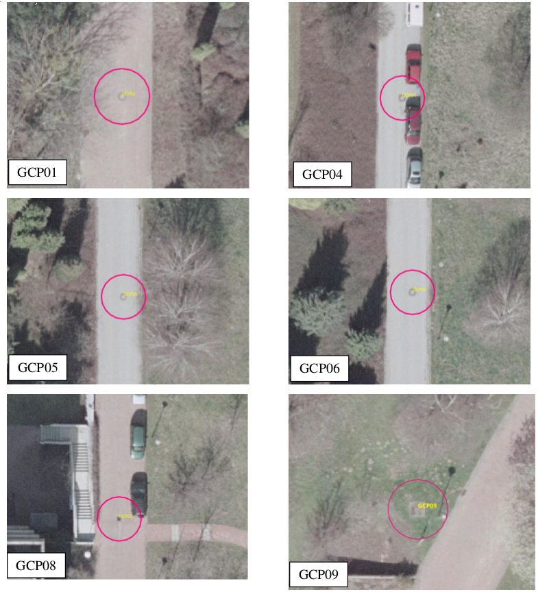
Ground control points (GCP's) used for Exercise 03b: Georeferencing of the QGIS tutorial 2013/14.
File history
Click on a date/time to view the file as it appeared at that time.
| Date/Time | Thumbnail | Dimensions | User | Comment | |
|---|---|---|---|---|---|
| current | 20:03, 8 December 2013 | | 801 × 864 (2.65 MB) | Lburgr (Talk | contribs) | Erased less aesthetically pleasing lines... |
| 19:47, 8 December 2013 |  | 801 × 864 (2.65 MB) | Lburgr (Talk | contribs) | ||
| 19:44, 8 December 2013 |  | 748 × 575 (474 KB) | Lburgr (Talk | contribs) | Ground control points (GCP's) used for Exercise 03b: Georeferencing of the QGIS tutorial 2013/14. |
- Edit this file using an external application (See the setup instructions for more information)
File usage
The following page links to this file: