Changing Raster Layer Style
From AWF-Wiki
| sorry: |
This section is still under construction! This article was last modified on 02/18/2011. If you have comments please use the Discussion page or contribute to the article! |
QGIS Tutorial
Category QGIS tutorial not found
- The raster layer properties are only to be used for displaying GDAL raster files. They won't have any effect on GRASS raster maps. If you're working on GRASS, see Displaying GRASS raster layers.
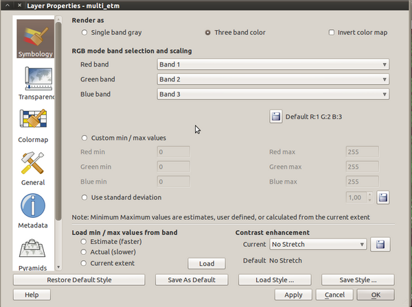
The raster layer propertiers differ from the vector layer properties, due to the significant differences of the data. You can open this dialog by double-clicking a raster layer in the TOC or right-clicking on the layer in the TOC and choosing Properties.

Raster layer properties in QGIS (on a LINUX OS)
From top to bottom, you find the following options:
- Symbology: here you can choose between two different ways of displaying the map:
- Single band gray - Here you can choose between four sub-options:
- Three band color
- Transparency: Set the raster transparency settings
- Colormap: set the rules for the corresponding symbology (see above)