File list
This special page shows all uploaded files. When filtered by user, only files where that user uploaded the most recent version of the file are shown.
| Name | Thumbnail | Size | User | Description | Versions | |
|---|---|---|---|---|---|---|
| 12:30, 30 January 2014 | Dieckmann.jpg (file) |  | 210 KB | Fehrmann | 1 | |
| 12:30, 30 January 2014 | Christoph Kleinn.jpg (file) | 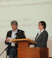 | 167 KB | Fehrmann | 1 | |
| 06:44, 30 January 2014 | Tennigkeit 29-01-2014.pdf (file) | 2.7 MB | Fehrmann | (Presentation given by Timm Tennigkeit) | 1 | |
| 06:41, 30 January 2014 | Van Tuyll 29-01-2014.pdf (file) | 1.2 MB | Fehrmann | (Presentation given by Cornelis van Tuyll) | 1 | |
| 15:49, 29 January 2014 | 2014-01 Göttingen Kanninen.pdf (file) | 1.71 MB | Fehrmann | (Presentation given by Prof. Dr. M. Kanninen.) | 1 | |
| 18:52, 25 January 2014 | RemSens Exercise05 06.png (file) | 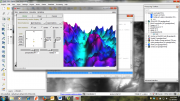 | 435 KB | Lburgr | (Screenshot of QGIS session with output window of the GRASS NVIZ plugin.) | 1 |
| 18:51, 25 January 2014 | RemSens Exercise05 05.png (file) | 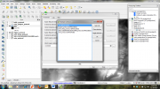 | 332 KB | Lburgr | (Screenshot of a QGIS 2.0 session with open NVIZ menu loaded via the GRASS plugin. ) | 1 |
| 18:11, 24 January 2014 | RemSens Exercise06 05.png (file) | 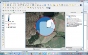 | 648 KB | Lburgr | (Screenshot of QGIS 2.0 session with Google satellite layer and a digitized sample point with landscape classes.) | 1 |
| 18:08, 24 January 2014 | RemSens Exercise06 04.png (file) | 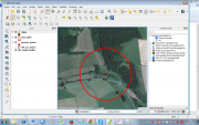 | 712 KB | Lburgr | (Screenshot of QGIS 2.0 session with loaded Google satellite layer and sample point for landscape classification.) | 1 |
| 18:07, 24 January 2014 | RemSens Exercise06 03.png (file) |  | 595 KB | Lburgr | (Screenshot of QGIS 2.0 session with Google sattelite layer of the vicinity of Göttingen, loaded via the ''Open layers'' plugin.) | 1 |
| 18:06, 24 January 2014 | RemSens Exercise06 02.png (file) |  | 671 KB | Lburgr | (Screenshot of QGIS 2.0 session with loaded landscape classification map and buffered sample points generated with the ''Regular points'' tool.) | 1 |
| 18:04, 24 January 2014 | RemSens Exercise06 01.png (file) | 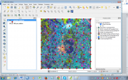 | 829 KB | Lburgr | (Screenshot of QGIS 2.0 session with loaded landscape classification map and sample points added with the ''Regular points'' tool.) | 1 |
| 17:03, 24 January 2014 | QGIS 2.0 Addpolygon.png (file) |  | 1 KB | Lburgr | (Screenshot of QGIS 2.0 ''Add polygon'' icon in edit mode.) | 1 |
| 15:42, 21 January 2014 | RemSens Exercise05 04.png (file) | 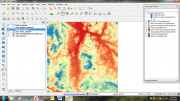 | 561 KB | Lburgr | (QGIS 2.0 session on windows with DEM raster displayed in pseudocolor.) | 1 |
| 15:41, 21 January 2014 | RemSens Exercise05 03.png (file) | 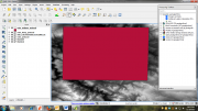 | 357 KB | Lburgr | (QGIS 2.0 session in Windows with result of the ''polygon from layer extent'' tool.) | 1 |
| 10:56, 21 January 2014 | RemSens Exercise05 02.png (file) | 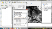 | 418 KB | Lburgr | (Screenshot of a QGIS 2.0 session with raster warp dialogue.) | 1 |
| 09:14, 21 January 2014 | RemSens Exercise05 01.png (file) | 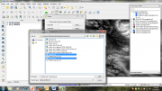 | 376 KB | Lburgr | (Screenshot of a QGIS 2.0 session with dialogue for the raster merge tool and file browser.) | 1 |
| 08:41, 15 January 2014 | Pointviewer-color.png (file) | 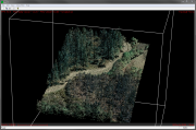 | 1.17 MB | Nnoelke | 1 | |
| 17:06, 14 January 2014 | Flyingcamp.jpg (file) | 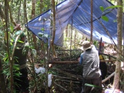 | 222 KB | Fehrmann | (Picture taken by Mats Mahnken during field work. Category:Picture of the week) | 1 |
| 16:46, 14 January 2014 | Cmd2.jpg (file) |  | 25 KB | Fehrmann | 1 | |
| 16:43, 14 January 2014 | Cmd.jpg (file) |  | 21 KB | Fehrmann | 1 | |
| 16:17, 14 January 2014 | PDQ1.jpg (file) |  | 80 KB | Fehrmann | 1 | |
| 15:35, 14 January 2014 | Dataviewer.jpg (file) |  | 73 KB | Fehrmann | 1 | |
| 15:28, 14 January 2014 | Fusion3.jpg (file) | 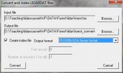 | 21 KB | Fehrmann | 1 | |
| 15:27, 14 January 2014 | Fusion4.jpg (file) |  | 87 KB | Fehrmann | 1 | |
| 15:27, 14 January 2014 | Fusion3a.jpg (file) | 28 KB | Fehrmann | 1 | ||
| 15:20, 14 January 2014 | Fusion1.jpg (file) | 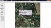 | 227 KB | Fehrmann | 1 | |
| 16:22, 8 January 2014 | Partners.png (file) | 97 KB | WikiSysop | 1 | ||
| 12:30, 8 January 2014 | Geodata.zip (file) | 89.61 MB | Hfuchs | 1 | ||
| 11:44, 10 December 2013 | RemSens Exercise03 9.png (file) | 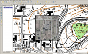 | 615 KB | Lburgr | (QGIS 2.0 with a georeferenced aerial photograph of the faculty for forestry, Göttingen, with underlying topographic map.) | 1 |
| 11:32, 10 December 2013 | RemSens Exercise03 7.png (file) |  | 373 KB | Lburgr | (Ground control point coordinate prompt in the QGIS 2.0 georeferencing dialogue. Part of Exercise 03b: Georeferencing of the QGIS tutorial 2013/14.) | 1 |
| 11:15, 10 December 2013 | RemSens Exercise03 6.png (file) | 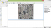 | 526 KB | Lburgr | (QGIS 2.0 with open georeferencing dialogue. Part of Exercise 03b: Georeferencing, part of the QGIS tutorial 2013/14.) | 1 |
| 17:30, 9 December 2013 | QGIS 2.0 georef run.png (file) |  | 530 B | Lburgr | (Screenshot of the ''Start georeferencing'' button in the QGIS 2.0 georeferencing dialogue.) | 1 |
| 17:18, 9 December 2013 | QGIS 2.0 georef addpoint.png (file) |  | 863 B | Lburgr | (Screenshot of the ''Add point'' icon in the QGIS 2.0 georeferencing dialogue.) | 1 |
| 17:14, 9 December 2013 | QGIS 2.0 georef zoom.png (file) |  | 908 B | Lburgr | (Screenshot of the ''zoom in'' tool icon in QGIS 2.0.) | 1 |
| 17:04, 9 December 2013 | QGIS 2.0 georef addrast.png (file) |  | 479 B | Lburgr | (Screenshot of the ''Add raster'' icon from the QGIS 2.0 georeferencing dialogue. ) | 1 |
| 19:03, 8 December 2013 | RemSens Exercise03 5.png (file) | 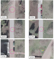 | 2.65 MB | Lburgr | (Erased less aesthetically pleasing lines...) | 3 |
| 18:24, 8 December 2013 | RemSens Exercise03 4.png (file) | 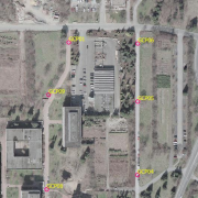 | 545 KB | Lburgr | (Aerial image of the faculty of forestry, Göttingen, with ground control points used for georeferencing in Exercise 03b: Georeferencing of the QGIS tutorial 2013/14.) | 1 |
| 17:24, 8 December 2013 | Landsat Goettingen 432.png (file) | 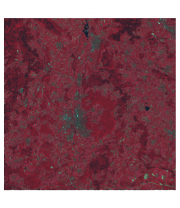 | 968 KB | Lburgr | (False color composite of LANDSAT bands 4,3, and 2 from the Göttingen area.) | 1 |
| 16:35, 8 December 2013 | RemSens Exercise03 2.png (file) | 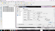 | 313 KB | Lburgr | (QGIS 2.0 with layer properties dialogue opened for a multiband raster image. Part of QGIS tutorial 2013/14 Exercise 03: Georeferencing.) | 1 |
| 10:56, 26 November 2013 | Trimble Waypoints.jpg (file) | 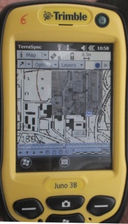 | 177 KB | Lburgr | (Image of the ''Trimble Juno 3B'' GPS receiver with displayed waypoints and background layer.) | 1 |
| 10:53, 26 November 2013 | Trimble Setup.jpg (file) | 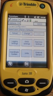 | 96 KB | Lburgr | (Image of the ''Trimble Juno 3B'' GPS receiver with open setup menu.) | 1 |
| 08:39, 26 November 2013 | Butress laserscan.png (file) | 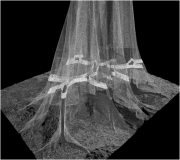 | 99 KB | WikiSysop | (3D laser-scan of a butress tree. Image created by Dominik Seidel in context of the TLS course Bogor. Category:Picture of the week) | 1 |
| 19:47, 16 November 2013 | QGIS RelPath.png (file) | 14 KB | Lburgr | (Screenshot of a section of a QGIS project file opened in gVim, with stored relative path to a shapefile.) | 1 | |
| 19:42, 16 November 2013 | QGIS AbsPath.png (file) | 19 KB | Lburgr | (Screenshot of an absolute path to a layer stored in a QGIS 2.0 project file.) | 1 | |
| 15:39, 16 November 2013 | QGIS 2.0 SaveEdit.png (file) |  | 755 B | Lburgr | (Screenshot of the ''save'' icon in QGIS 2.0 editing mode.) | 1 |
| 15:29, 16 November 2013 | QGIS 2.0 Edit.png (file) |  | 840 B | Lburgr | (Screenshot of QGIS 2.0 ''Toggle edit'' icon.) | 1 |
| 14:53, 16 November 2013 | QGIS 2.0 GPSTools.png (file) |  | 565 B | Lburgr | (Screenshot of the QGIS GPSTools plugin icon.) | 1 |
| 14:16, 16 November 2013 | RemSens Exercise02 1.png (file) | 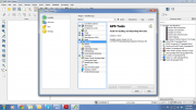 | 181 KB | Lburgr | (QGIS Screenshot with opened plugin manager. Part of QGIS Tutorial 2013/14 exercise 02.) | 1 |
| 13:59, 11 November 2013 | QGIS 2.0 addvect.png (file) |  | 1 KB | Lburgr | (Screenshot of "Add vector layer" icon in QGIS 2.0) | 1 |
 First page |
 Previous page |
 Next page |
 Last page |