File list
This special page shows all uploaded files. When filtered by user, only files where that user uploaded the most recent version of the file are shown.
| Name | Thumbnail | Size | User | Description | Versions | |
|---|---|---|---|---|---|---|
| 19:36, 10 November 2013 | Satellite orbit.png (file) |  | 549 KB | Pmagdon | 1 | |
| 17:58, 10 November 2013 | ImageCoordinateSystem.png (file) | 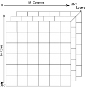 | 14 KB | Pmagdon | 1 | |
| 19:17, 9 November 2013 | QGIS 2.0 zoomtolayer.png (file) |  | 993 B | Lburgr | (Icon for zoom to layer function in QGIS 2.0.) | 1 |
| 19:16, 9 November 2013 | QGIS 2.0 zoominout.png (file) |  | 1 KB | Lburgr | (Icons for zooming in and out in QGIS 2.0.) | 1 |
| 19:12, 9 November 2013 | QGIS 2.0 addrast.png (file) |  | 509 B | Lburgr | (Screenshot of QGIS 2.0 add raster layer icon.) | 1 |
| 19:01, 9 November 2013 | RemSens Exercise01 4.png (file) | 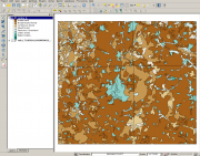 | 630 KB | Lburgr | (CORINE landcover map for Göttingen and vicinity in QGIS. Part of exercise one of the QGIS tutorial 2013/14.) | 1 |
| 18:09, 9 November 2013 | RemSens Exercise01 2.png (file) |  | 56 KB | Lburgr | (Screenshot of a histogram of pixel values of a ''landsat'' map, generated in the course of QGIS Tutorial 2013/14, Exercise 01.) | 1 |
| 11:15, 9 November 2013 | RemSens Exercise01 1.png (file) |  | 951 KB | Lburgr | (Screenshot for Exercise01 of the QGIS Tutorial 2013/14, after loading a ''landsat'' map into QGIS.) | 1 |
| 11:11, 4 November 2013 | High precision Low accuracy.png (file) |  | 20 KB | WikiSysop | 1 | |
| 11:11, 4 November 2013 | High accuracy Low precision.png (file) |  | 20 KB | WikiSysop | 1 | |
| 17:16, 30 October 2013 | Electromagnetic spectrum modified.png (file) |  | 34 KB | Hfuchs | 1 | |
| 15:44, 30 October 2013 | Accuracy.png (file) |  | 25 KB | WikiSysop | 2 | |
| 15:54, 29 October 2013 | Radiation2.gif (file) |  | 128 KB | Hfuchs | 1 | |
| 15:50, 29 October 2013 | Electromagneticwave3D.gif (file) |  | 128 KB | Hfuchs | 1 | |
| 11:37, 28 October 2013 | K-tree vs fixed plots density.png (file) | 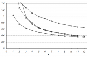 | 7 KB | WikiSysop | 1 | |
| 11:37, 28 October 2013 | K-tree vs fixed plots.png (file) | 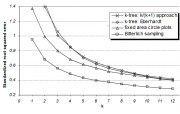 | 85 KB | WikiSysop | 1 | |
| 11:15, 27 October 2013 | EffectiveTemperature 300dpi e.png (file) | 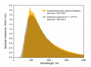 | 84 KB | Hfuchs | 1 | |
| 09:42, 25 October 2013 | Onde EMR.png (file) | 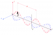 | 63 KB | Hfuchs | 1 | |
| 15:37, 20 October 2013 | Saga gis logo.png (file) |  | 6 KB | Hfuchs | 2 | |
| 15:36, 20 October 2013 | Rlogo-1.png (file) |  | 541 KB | Hfuchs | 1 | |
| 15:35, 20 October 2013 | Grasslogo vector big.png (file) |  | 18 KB | Hfuchs | 1 | |
| 15:34, 20 October 2013 | LogoOTB.png (file) |  | 15 KB | Hfuchs | 1 | |
| 15:34, 20 October 2013 | Gdal logo.png (file) |  | 113 KB | Hfuchs | 1 | |
| 15:07, 20 October 2013 | Startup qgis20.png (file) |  | 320 KB | Hfuchs | 1 | |
| 14:02, 18 September 2013 | TLS1.jpg (file) | 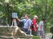 | 498 KB | WikiSysop | (Some impressions from the trainings course (Fotos taken by Hartanto Sanjaya Center of Technology for Natural Resources Inventory Agency for The Assessment and Application of Technology (BPPT))) | 1 |
| 14:01, 18 September 2013 | Scanner display.jpg (file) | 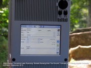 | 294 KB | WikiSysop | (Some impressions from the trainings course (Fotos taken by Hartanto Sanjaya Center of Technology for Natural Resources Inventory Agency for The Assessment and Application of Technology (BPPT))) | 1 |
| 14:01, 18 September 2013 | Scanner.jpg (file) | 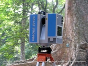 | 370 KB | WikiSysop | (Some impressions from the trainings course (Fotos taken by Hartanto Sanjaya Center of Technology for Natural Resources Inventory Agency for The Assessment and Application of Technology (BPPT))) | 1 |
| 14:00, 18 September 2013 | Butress tree.jpg (file) | 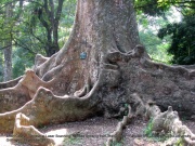 | 543 KB | WikiSysop | (Some impressions from the trainings course (Fotos taken by Hartanto Sanjaya Center of Technology for Natural Resources Inventory Agency for The Assessment and Application of Technology (BPPT))) | 1 |
| 13:53, 18 September 2013 | TLS-Bogor-small.jpg (file) |  | 214 KB | WikiSysop | (Hartanto Sanjaya Center of Technology for Natural Resources Inventory Agency for The Assessment and Application of Technology (BPPT)) | 1 |
| 13:52, 18 September 2013 | TLS-Bogor.jpg (file) |  | 572 KB | WikiSysop | (Picture from Hartanto Sanjaya Center of Technology for Natural Resources Inventory Agency for The Assessment and Application of Technology (BPPT)) | 1 |
| 16:00, 11 September 2013 | Supervised Classification.png (file) |  | 64 KB | Lburgr | (* Corrected oversights (changed "spatial signature" to "spectral signature"). * Changed working step structure to fit the one in the lecture * Improved overall structure) | 4 |
| 13:22, 10 September 2013 | Hunagshan.JPG (file) |  | 73 KB | Fehrmann | 2 | |
| 13:15, 10 September 2013 | Shitai inventory.jpg (file) |  | 173 KB | Fehrmann | 1 | |
| 14:36, 3 September 2013 | Hierarchical Clustering.png (file) |  | 52 KB | Lburgr | (An example R plot to illustrate hierarchical clustering, containing fictional data points and a dendrogram. R Code: ## Some fictional satellite brightness values: rm(list=ls()) set.seed(23) # just change the seed to see different outcomes! da...) | 1 |
| 11:05, 3 August 2013 | Iterative Clustering.png (file) |  | 113 KB | Lburgr | (Added main title.) | 2 |
| 15:14, 25 June 2013 | Landsat corr.png (file) | 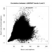 | 78 KB | Lburgr | (Correlation of LANDSAT bands 4 and 5, based on the input data provided for the exercises of the lecture "Remote sensing image processing with open source GIS". A link to the data will be provided as soon as it is downloadable. Code: library(rgdal) ...) | 1 |
| 11:01, 21 June 2013 | Landsat corr fake.png (file) | 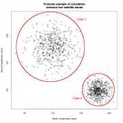 | 2.45 MB | Lburgr | (A plot of fictional correlation between brightness values of two satellite bands. Generated in R and edited with GIMP. Code: -------------------------------------------------------------------- data <- data.frame(band.4=c(rnorm(500, mean=100, sd=20), ...) | 1 |
| 14:25, 28 May 2013 | AcquisitionGeometry.png (file) | 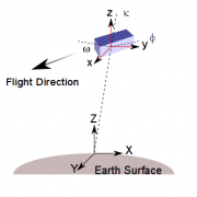 | 17 KB | Pmagdon | 1 | |
| 15:55, 21 March 2013 | Field work.jpg (file) | 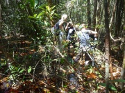 | 241 KB | Fehrmann | 1 | |
| 15:54, 21 March 2013 | Tower.jpg (file) | 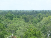 | 206 KB | Fehrmann | 1 | |
| 15:53, 21 March 2013 | Channel.jpg (file) |  | 177 KB | Fehrmann | 1 | |
| 13:50, 21 March 2013 | AWF-Wiki portal banner4.jpg (file) | 58 KB | Fehrmann | (Reverted to version as of 12:47, 21 March 2013) | 3 | |
| 08:18, 7 March 2013 | 80j Eucalyptus grandis Westfalia Hans Merensky.JPG (file) | 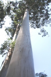 | 178 KB | Fehrmann | (Picture taken by Christoph Kleinn. 80 years old Eucalyptus grandis, Westfalia farm of Hans Merensky Foundation. Category:Picture of the week) | 1 |
| 08:16, 7 March 2013 | Sunland Baobab2.JPG (file) |  | 212 KB | Fehrmann | ( category:picture of the week) | 1 |
| 08:16, 7 March 2013 | Sunland Baobab1.JPG (file) | 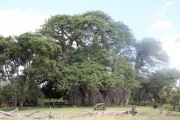 | 193 KB | Fehrmann | (Picture taken by Christoph Kleinn. Sunland Farm South Africa. Estmated age is 6.000 years what makes it to one of the oldest trees on the world. Diameter is more than 10m. The hollow stem accommodates a wine cellar. Catergory:picture of the week) | 1 |
| 08:07, 3 March 2013 | AWF-Wiki portal banner12.jpg (file) | 100 KB | Fehrmann | (category:Banner) | 1 | |
| 07:57, 3 March 2013 | Bogor5.jpg (file) | 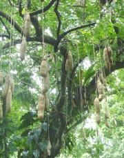 | 221 KB | Fehrmann | (category:picture of the week) | 1 |
| 12:00, 30 January 2013 | AWF-Wiki portal banner11.jpg (file) | 83 KB | Fehrmann | 1 | ||
| 11:45, 30 January 2013 | AWF-Wiki portal banner9.jpg (file) | 167 KB | Fehrmann | 1 | ||
| 09:39, 8 January 2013 | Wedge-prism02 OUT.jpg (file) |  | 71 KB | Fehrmann | 1 |
 First page |
 Previous page |
 Next page |
 Last page |