GSG
(→Construction of a discrete global sampling grid) |
|||
| Line 7: | Line 7: | ||
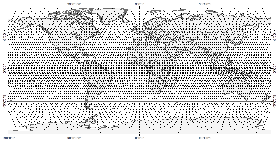
We propose a very simple and easy to communicate discrete global grid system (Global Sampling Grid = GSG) that could serve as basic [[:category:sampling design|sampling design]] from global to local scale. The grid construction follows a simple approach: Circles of latitudes are placed with a constant distance on the surface of a sphere with radius of 6378.137 m (major axis of the World Geodetic System, WGS84) outgoing from the equator in North and South direction. On each of these latitudes sampling locations are placed in the same constant distance outgoing from the Greenwich meridian in West and East direction. This leads to a half systematic arrangement of sampling locations, where the distance of points is constant along the latitudes. | We propose a very simple and easy to communicate discrete global grid system (Global Sampling Grid = GSG) that could serve as basic [[:category:sampling design|sampling design]] from global to local scale. The grid construction follows a simple approach: Circles of latitudes are placed with a constant distance on the surface of a sphere with radius of 6378.137 m (major axis of the World Geodetic System, WGS84) outgoing from the equator in North and South direction. On each of these latitudes sampling locations are placed in the same constant distance outgoing from the Greenwich meridian in West and East direction. This leads to a half systematic arrangement of sampling locations, where the distance of points is constant along the latitudes. | ||
| − | [[File:GSG_250_global.png | + | [[File:GSG_250_global.png]] |
Revision as of 12:46, 24 September 2014
A unified framework for environmental monitoring based on a discrete global sampling grid system (GSG)
Background
Environmental monitoring on different spatial scales is a key element in many international and national processes related to ecological and environmental challenges. The increasing availability of large archives of freely available high resolution and Geo-referenced imagery through virtual globes like Google Earth, Microsoft Virtual Earth (bing) or NASA World Wind and others is still relatively underexploited by scientific applications in this context. Even if these information sources are frequently used by scientists, e.g. for communication and visualization of project activities or even as basis for observations in remote sensing imagery, there is hardly any methodological framework that helps to make use of the data sources for sample based estimation. Depending on the available spatial resolution of images, many relevant target variables, like e.g. forest cover, could be interpreted visually and could serve as basis for statistical estimation on larger areas.
Construction of a discrete global sampling grid
We propose a very simple and easy to communicate discrete global grid system (Global Sampling Grid = GSG) that could serve as basic sampling design from global to local scale. The grid construction follows a simple approach: Circles of latitudes are placed with a constant distance on the surface of a sphere with radius of 6378.137 m (major axis of the World Geodetic System, WGS84) outgoing from the equator in North and South direction. On each of these latitudes sampling locations are placed in the same constant distance outgoing from the Greenwich meridian in West and East direction. This leads to a half systematic arrangement of sampling locations, where the distance of points is constant along the latitudes.
