Using Qgis2threejs
From AWF-Wiki
(Difference between revisions)
(Created page with "[https://plugins.qgis.org/plugins/Qgis2threejs/ Qgis2threejs] plugin exports terrain data, map canvas image and vector data to your web browser. You can view exported 3D objec...") |
|||
| Line 1: | Line 1: | ||
[https://plugins.qgis.org/plugins/Qgis2threejs/ Qgis2threejs] plugin exports terrain data, map canvas image and vector data to your web browser. You can view exported 3D objects on web browser which supports WebGL. | [https://plugins.qgis.org/plugins/Qgis2threejs/ Qgis2threejs] plugin exports terrain data, map canvas image and vector data to your web browser. You can view exported 3D objects on web browser which supports WebGL. | ||
| + | |||
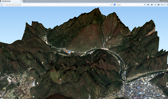
| + | [[File:Qgis2Threejs.PNG|3D Visualization]] | ||
==External Tutorials== | ==External Tutorials== | ||
Revision as of 14:07, 24 September 2014
Qgis2threejs plugin exports terrain data, map canvas image and vector data to your web browser. You can view exported 3D objects on web browser which supports WebGL.
