Freak out
From AWF-Wiki
(Difference between revisions)
(Created page with "{{Content Tree|HEADER=QGIS Tutorial|NAME=QGIS tutorial}} The freak-out option creates a color ramp of quite psychedelic colors which are assigned to intervals of raster values a...") |
|||
| (5 intermediate revisions by one user not shown) | |||
| Line 1: | Line 1: | ||
{{Content Tree|HEADER=QGIS Tutorial|NAME=QGIS tutorial}} | {{Content Tree|HEADER=QGIS Tutorial|NAME=QGIS tutorial}} | ||
| − | The freak-out option creates a color ramp of quite psychedelic colors which are assigned to intervals of raster values at random. Therefor, it does not give much extra help for interpretation, it's only applicable for displaying | + | The freak-out option creates a color ramp of quite psychedelic colors which are assigned to intervals of raster values at random. Therefor, it does not give much extra help for interpretation, it's only applicable for displaying varying data in a spectacular visualization. |
| + | |||
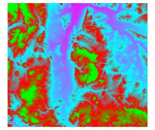
| + | [[File:dem_freak.jpg|500px|thumb|A digital elevation model (DEM) displayed by the “freak out” option|center]] | ||
==Related articles== | ==Related articles== | ||
* [[Raster layer properties]] | * [[Raster layer properties]] | ||
| − | * [[ | + | * [[Grayscale]] |
* [[Pseudocolor]] | * [[Pseudocolor]] | ||
* [[Colormap]] | * [[Colormap]] | ||
Latest revision as of 13:39, 17 February 2011
QGIS Tutorial
Category QGIS tutorial not found
The freak-out option creates a color ramp of quite psychedelic colors which are assigned to intervals of raster values at random. Therefor, it does not give much extra help for interpretation, it's only applicable for displaying varying data in a spectacular visualization.
