Talk:Data type conversion
From AWF-Wiki
This is not a smart solution!:
We may change the data type (or radiometric resolution) of a raster layer.
- Click the Add raster layer
 and select a single band file /geodata/raster/s2/Subset_S2A_MSIL2A_20170619T_B03.tif. This is a spectral green band with the data type UInt16 - Sixteen bit unsigned integer with the value range 0 to 65535 (Check the Raster metadata). We would like to convert the raster to data type Byte - eight bit unsigned integer, value range 0 to 255.
- Click Open.
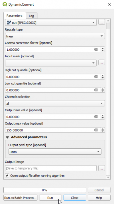
- In processing toolbar, type Rescale into the search field to find the Orfeo Toolbox --> Image Manipulation --> Rescale Image) tool. Open it with a double click. Specify a new output file name as shown in the screenshot.
The output Image raster is now recoded to correct eight bit data range but the data type is now Float32 - Thirty two bit floating point. Note, the Output pixel type option uint8 currently does not work!
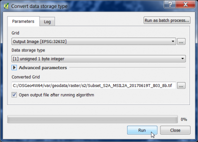
- In the processing toolbar, type Convert data into the search field to find the SAGA --> Raster tools --> Convert data storage) tool. Open with a double click.
Specify
- Data storage type: [1] unsigned 1 byte integer
- Converted grid: a new output file name. Click Run.

