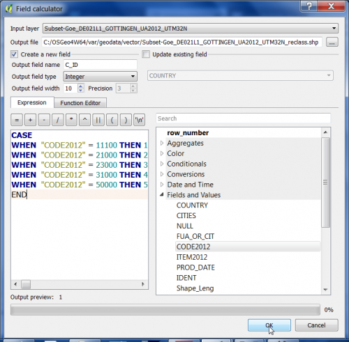
Conditional field calculator
From AWF-Wiki
We would like to use the European Urban Atlas as an information vector layer to automatically extract reference data for an actual land cover classification. The original Urban Atlas classifcation scheme has 37 classes. We need to define some strata for sampling training data for land cover classification.
- Click Add vector layer
 and select file geodata/vector/Subset-Goe_DE021L1_GOTTINGEN_UA2012_UTM32N.shp.
- This file still contains geometry errors (ring self-intersections). Check with Vector --> Geometry Tools --> Check Validity Field calculator}}
- Repair the vector file: Processing Tools --> Vector geometry --> Fix geometries. Save the output fixed geometry file as Geppackage with the extension *.gpkg.
- In the processing toolbar, type Field calculator to browse for the QGIS --> Vector Table Tools --> Field calculator and open it.
- Define name and path of a new vector Output layer. Tick Create new field, specify the Output field name stratum as Whole number (integer).
- Formulate 5 conditional operations creating a new vector file adding a new column named stratum:
CASE
WHEN "CODE2012" = 11100 THEN 1
WHEN "CODE2012" = 21000 THEN 2
WHEN "CODE2012" = 23000 THEN 3
WHEN "CODE2012" = 31000 THEN 4
WHEN "CODE2012" = 50000 THEN 5
END
