Training data selection (SCP)
From AWF-Wiki
(Difference between revisions)
| Line 2: | Line 2: | ||
Before starting to map land cover classes using Sentinel-2 satellite images we need clear definitions and a classification scheme. | Before starting to map land cover classes using Sentinel-2 satellite images we need clear definitions and a classification scheme. | ||
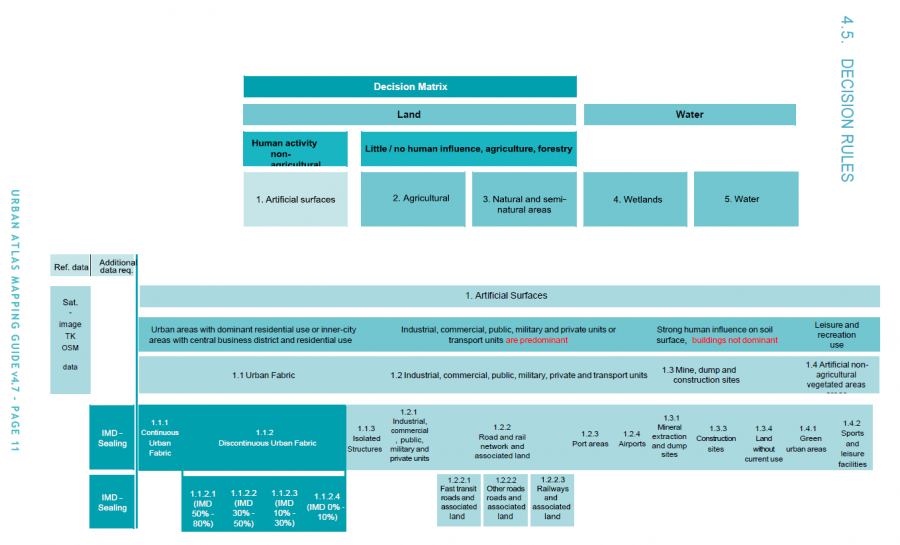
An example of a hierarchical land use and land cover classification scheme is the European Urban Atlas. | An example of a hierarchical land use and land cover classification scheme is the European Urban Atlas. | ||
| − | [[File:qgis_urban_atlas_scheme.png| | + | [[File:qgis_urban_atlas_scheme.png|900px]] |
The scheme focusses on built-up classes whil the | The scheme focusses on built-up classes whil the | ||
[[category:QGIS Tutorial]] | [[category:QGIS Tutorial]] | ||
Revision as of 09:48, 19 April 2018
Definition of land cover classes
Before starting to map land cover classes using Sentinel-2 satellite images we need clear definitions and a classification scheme.
An example of a hierarchical land use and land cover classification scheme is the European Urban Atlas.
 The scheme focusses on built-up classes whil the