Processing Ebee UAV images
From AWF-Wiki
Post Flight Processing in Emotion3 software
- Find and copy the flight log (*.bb3) for the mission that should be processed
- Find and copy the folder with the images for the mission that should be processed
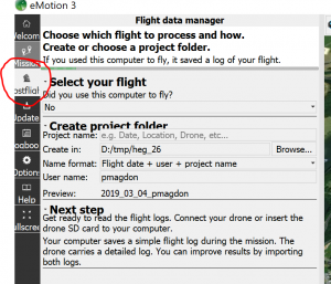
- Start Emotion3 Software and select Postflight
- Assign project name (use PlotID here e.g. AEG04)
- Select output folder and confirm with 'next'
- Browse for the *.bb3 file and confirm with 'next'
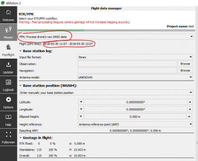
- In the next tab select PPK: Process drones' raw GNSS data
- Prepare a RINEX observation file by recording the GPS time and duration of the flight and select the approximate center coordinates of the flight area as position for the virtual refernce station.
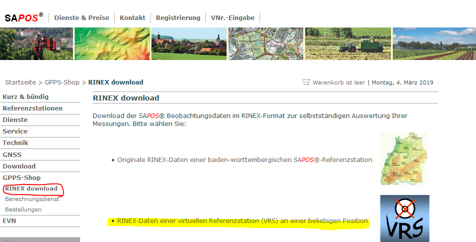
- Go to SAPOS and login in
- Select GNSS Shop -> RINEX Download -> Virtual Reference Station (VRS)
- Enter the date, time, duration and coordinates of the VRS into the form. Select 1 second intervalls for Ebee data
- Submitt the order and wait until the processing is finished
- Download the RINEX Zip file, extract it and insert the path to the observation file (*.o) to the Emotion3 software
Now the reference station coordinates and antenna model should become visible
- Start GNSS-Postprocessing by confirming the settings with 'next'
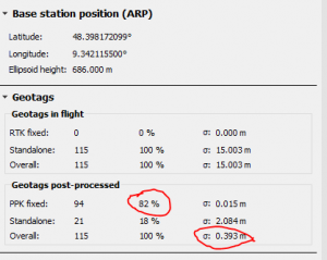
- Check if post processing was applied to all / most of the images and controll for the final positional accuracy


