Line segment extraction
From AWF-Wiki
(Difference between revisions)
| Line 4: | Line 4: | ||
[[File:Qgis_edge_line.png|700px]] | [[File:Qgis_edge_line.png|700px]] | ||
{| class="wikitable" | {| class="wikitable" | ||
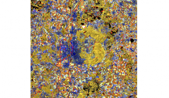
| − | |style="border: 0pt" | [[file:Qgis_goe_line.png|thumb|left|700px|'''Figure A:''' Input image: pansharpend Sentinel-2 composite (RGB= B7,B6,B5) overlaid with detected line vectors (red]] | + | |style="border: 0pt" | [[file:Qgis_goe_line.png|thumb|left|700px|'''Figure A:''' Input image: pansharpend Sentinel-2 composite (RGB= B7,B6,B5) overlaid with detected line vectors (red)]] |
|} | |} | ||
[[category:Spatial Filtering]] | [[category:Spatial Filtering]] | ||
Revision as of 13:51, 20 November 2017
The Line Segment Detection application (LSD) detects locally straight contours in an image and was published by Grompone et al. (2012). It is based on a spatial edge extraction filter.
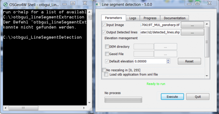
- In the Search box of the Windows Start menu type OSGeo4W Shell. You should be able to open the shell by clicking on it.
- Type into the shell: otbgui_LineSegementDetection. Select a multiband input file. Parameter tuning is not necessary.

