Exercise : Measuring heights of trees outside the forest (TOF) in digital orthophotos (DOP)
From AWF-Wiki
(Difference between revisions)
(→Shadows in orthorectified remote sensing images) |
(→Shadows in orthorectified remote sensing images) |
||
| Line 1: | Line 1: | ||
==Shadows in orthorectified remote sensing images== | ==Shadows in orthorectified remote sensing images== | ||
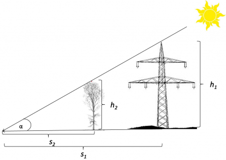
| − | [[Image:shadow_length.png|450px|thumb|right|'''Figure A''': Shadow length ''s'' and object height ''h | + | [[Image:shadow_length.png|450px|thumb|right|'''Figure A''': Shadow length ''s'' and object height ''h'']] |
==Estimating sun elevation== | ==Estimating sun elevation== | ||
Revision as of 16:44, 14 July 2014
Contents |
