Search results
File:Best Rapideye.jpg Image by Lutz Fehrmann(971 × 870 (910 KB)) - 13:37, 19 November 2012
File:Landsat corr.png for the exercises of the lecture "Remote sensing image processing with open source GIS". A link to the data will be provided as so(800 × 800 (78 KB)) - 14:20, 25 June 2013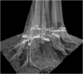
File:Butress laserscan.png 3D laser-scan of a butress tree. Image created by [[User:Dseidel|Dominik Seidel]] in context of the [[TLS course B(457 × 407 (99 KB)) - 07:39, 26 November 2013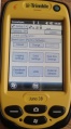
File:Trimble Setup.jpg Image of the ''Trimble Juno 3B'' GPS receiver with open setup menu.(398 × 717 (96 KB)) - 09:53, 26 November 2013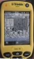
File:Trimble Waypoints.jpg Image of the ''Trimble Juno 3B'' GPS receiver with displayed waypoints and backgr(540 × 946 (177 KB)) - 09:56, 26 November 2013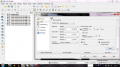
File:RemSens Exercise03 2.png [[QGIS]] 2.0 with layer properties dialogue opened for a multiband raster image. Part of [[QGIS tutorial 2013/14]] [[Exercise 03: Georeferencing]].(1,366 × 768 (313 KB)) - 15:35, 8 December 2013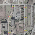
File:RemSens Exercise03 4.png Aerial image of the faculty of forestry, Göttingen, with ground control points used for(530 × 530 (545 KB)) - 17:24, 8 December 2013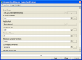
File:RemSens Exercise07 01.png Screenshot of the Orfeo-Toolbox unsupervised KMeans image classification plugin dialogue in [[QGIS]] 2.0. Part of [[QGIS Tutorial 201(658 × 484 (25 KB)) - 10:18, 17 February 2014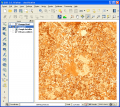
File:RemSens Exercise07 02.png Landcover map produced by the Orfeo-Toolbox unsupervised K-Means image classification plugin in [[QGIS 2.0]]. Part of the [[QGIS Tutorial 2013/14](800 × 711 (375 KB)) - 10:19, 17 February 2014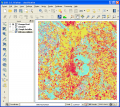
File:RemSens Exercise07 03.png Landcover map produced by unsupervised K-Means image classification plugin from the Orfeo-Toolbox in [[QGIS]], 2.0 displayed in(800 × 711 (223 KB)) - 10:21, 17 February 2014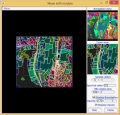
File:Monteverdi Mean shift.png Screenshot of the ''Mean shift'' module in Monteverdi with loaded satellite image.(591 × 566 (982 KB)) - 15:10, 18 February 2014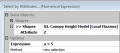
File:SelectByAt.png [[Image:|350px]thumb|right|'''Figure B''': ]](370 × 164 (178 KB)) - 12:55, 18 July 2014


