Making the Mekong Connected
(→Background) |
(→Project Goals) |
||
| (One intermediate revision by one user not shown) | |||
| Line 22: | Line 22: | ||
| − | In recent decades, the upper Mekong Region has overcome an important conversion of secondary forest and swidden-fallow succession to plantation economy driven by regional and global markets and state policies, with the consequence of increasing greenhouse gas emission and biodiversity loss. Secondary forests with rich biodiversity continue to be replaced by fruit tree and rubber plantations and, more recently, with Jatropha. How these conversion from existing land cover to plantation affect local carbon and biodiversity, and what are the consequences of those changes for carbon sequestration, biodiversity, and ecosystem services is one of the main research questions of the MMC project. Besides that it will also be investigated, what good land use practices for enhancing biodiversity and carbon assets at landscape level are, and what the institutional arrangements and incentives for support of landscape connectivity and functionality in the Upper Mekong Region are. The project aims to support enhanced and connected multifunctional landscape corridors with both positive livelihood and environmental benefits managed by smallholder farmers through integrated management and financial mechanisms; and hence contribute to sustainable land-use policies and practices. It will generate knowledge, tools, biodiversity, and carbon assets for local development and regional environmental protection. Smallholder farmers, including many indigenous ethnic communities, which play an important role in protecting forests, landscapes, and watersheds, and maintaining biodiversity through traditional land-use practices, such as agroforestry, will be the main beneficiaries | + | In recent decades, the upper Mekong Region has overcome an important conversion of secondary forest and swidden-fallow succession to plantation economy driven by regional and global markets and state policies, with the consequence of increasing greenhouse gas emission and biodiversity loss. Secondary forests with rich biodiversity continue to be replaced by fruit tree and rubber plantations and, more recently, with Jatropha. How these conversion from existing land cover to plantation affect local carbon and biodiversity, and what are the consequences of those changes for carbon sequestration, biodiversity, and ecosystem services is one of the main research questions of the MMC project. Besides that it will also be investigated, what good land use practices for enhancing biodiversity and carbon assets at landscape level are, and what the institutional arrangements and incentives for support of landscape connectivity and functionality in the Upper Mekong Region are. The project aims to support enhanced and connected multifunctional landscape corridors with both positive livelihood and environmental benefits managed by smallholder farmers through integrated management and financial mechanisms; and hence contribute to sustainable land-use policies and practices. It will generate knowledge, tools, biodiversity, and carbon assets for local development and regional environmental protection. Smallholder farmers, including many indigenous ethnic communities, which play an important role in protecting forests, landscapes, and watersheds, and maintaining biodiversity through traditional land-use practices, such as agroforestry, will be the main beneficiaries. |
==Project Goals== | ==Project Goals== | ||
| − | The project | + | The following research questions are going to be answered by the MMC project: “How does the conversion from existing land cover to plantation affect local carbon and biodiversity, and what are the consequences of those changes for carbon sequestration, biodiversity, and ecosystem services?” and “ What are the good land use practices for enhancing biodiversity and carbon assets at landscape level? What are the institutional arrangements and incentives for support of landscape connectivity and functionality in the Upper Mekong Region?” Besides a thorough analysis of remote sensing data and ancient and actual maps this requires location-based biophysical sampling plots on different land use types and socioeconomic narratives about land-use history. Furthermore, development of carbon and biodiversity assets involves improved land-management practices, land-use decisions, and institutional arrangements as well as active participation of different stakeholders. The projects major outputs will be: a) land-use dynamics for the study sites assessed; b) biodiversity and carbon assets assessed; c) opportunities for carbon financing and biodiversity offset determined; d) capacity of national partners and key stakeholders enhanced. |
[[Category:Projects]] | [[Category:Projects]] | ||
Latest revision as of 10:04, 11 January 2013
Project Title: Making the Mekong Connected
- Funding: BMZ / GTZ (Advisory Group on International Agricultural Research BEAF)
- Duration: 2009-2012
- Coordination: Prof. Dr. Xu Jianchu / Prof. Dr. Christoph Kleinn
- Project researcher: Philip Beckschäfer
[edit] Background
- The Upper Mekong Region (south China, north Laos and Thailand, east Myanmar) is an ecologically important and vital region for the lower Mekong countries.
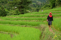
- Smallholder farmers, including many indigenous ethnic communities play an important role in protecting forests,landscapes, and watersheds. They maintain biodiversity through traditional land-use practices.
- Problem: Secondary forests with rich biodiversity continue to be replaced by fruit tree and rubber plantations and, more recently, with Jatropha.
In recent decades, the upper Mekong Region has overcome an important conversion of secondary forest and swidden-fallow succession to plantation economy driven by regional and global markets and state policies, with the consequence of increasing greenhouse gas emission and biodiversity loss. Secondary forests with rich biodiversity continue to be replaced by fruit tree and rubber plantations and, more recently, with Jatropha. How these conversion from existing land cover to plantation affect local carbon and biodiversity, and what are the consequences of those changes for carbon sequestration, biodiversity, and ecosystem services is one of the main research questions of the MMC project. Besides that it will also be investigated, what good land use practices for enhancing biodiversity and carbon assets at landscape level are, and what the institutional arrangements and incentives for support of landscape connectivity and functionality in the Upper Mekong Region are. The project aims to support enhanced and connected multifunctional landscape corridors with both positive livelihood and environmental benefits managed by smallholder farmers through integrated management and financial mechanisms; and hence contribute to sustainable land-use policies and practices. It will generate knowledge, tools, biodiversity, and carbon assets for local development and regional environmental protection. Smallholder farmers, including many indigenous ethnic communities, which play an important role in protecting forests, landscapes, and watersheds, and maintaining biodiversity through traditional land-use practices, such as agroforestry, will be the main beneficiaries.
[edit] Project Goals
The following research questions are going to be answered by the MMC project: “How does the conversion from existing land cover to plantation affect local carbon and biodiversity, and what are the consequences of those changes for carbon sequestration, biodiversity, and ecosystem services?” and “ What are the good land use practices for enhancing biodiversity and carbon assets at landscape level? What are the institutional arrangements and incentives for support of landscape connectivity and functionality in the Upper Mekong Region?” Besides a thorough analysis of remote sensing data and ancient and actual maps this requires location-based biophysical sampling plots on different land use types and socioeconomic narratives about land-use history. Furthermore, development of carbon and biodiversity assets involves improved land-management practices, land-use decisions, and institutional arrangements as well as active participation of different stakeholders. The projects major outputs will be: a) land-use dynamics for the study sites assessed; b) biodiversity and carbon assets assessed; c) opportunities for carbon financing and biodiversity offset determined; d) capacity of national partners and key stakeholders enhanced.


