What is a "Nodata value"
From AWF-Wiki
A nodata value simply is a pixel value in a vector or raster map representing no information. It is not to be confused with a pixel value of 0 (zero).
E.g. in a raster-map containing temperatures of a surface in °C, a pixel value of 0 represents a temperature of 0 °C, while a nodata-pixel simply represents a part of the surface where no information on the temperature is available.
Accumulations of neighboring pixels result in so called “nodata-areas”.

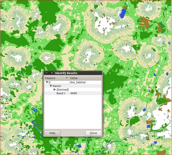
A rastermap in QGIS. The white space where the mouse points at indicates a nodata area. The open identify feature window displays a value of -9999, a common nodata value in Arc/Info ASCII grid
The way nodata values are saved depends on the respective data type, but may also vary within. They may be saved as numbers or strings. Examples are shown in the table below.
| Data type | Nodata value (string) | Nodata value (number) |
|---|---|---|
| GRASS raster | null | |
| GeoTIFF | nan | |
| Arc/Info ASCII Grid | -9999 |
In QGIS, information on the nodata value can be obtained from the layer properties (Metadata) and/or General tab).