File:2.1.3.5-fig3.png
From AWF-Wiki
No higher resolution available.
2.1.3.5-fig3.png (319 × 518 pixels, file size: 485 KB, MIME type: image/png)
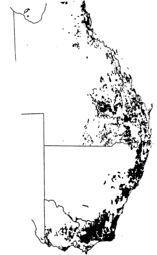
Forest cover map of Eastern Australia (Bureau of Rural Resources 1991). At the boundary between the two provinces a marked change of the spatial arrangement of forest patches can be observed.
File history
Click on a date/time to view the file as it appeared at that time.
| Date/Time | Thumbnail | Dimensions | User | Comment | |
|---|---|---|---|---|---|
| current | 15:22, 18 January 2011 | | 319 × 518 (485 KB) | Aspange (Talk | contribs) | Forest cover map of Eastern Australia (Bureau of Rural Resources 1991). At the boundary between the two provinces a marked change of the spatial arrangement of forest patches can be observed. |
- Edit this file using an external application (See the setup instructions for more information)
File usage
The following page links to this file: