Development of an integrated forest carbon monitoring system
Project Title: Development of an integrated forest carbon monitoring system with field sampling and remote sensing (Central Kalimantan)
- Funding: DFG
- Duration: 2012-2015
- Coordination: Prof. Dr. Christoph Kleinn and Prof. Dr. Florian Siegert
- Project researcher: Dr. César Perez, Dr. Paul Magdon and Yanti Sarodja (PhD)
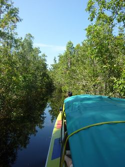
- Study sites: Sabangau National Park, Central Kalimantan
- WebGIS
Background
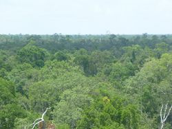
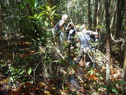
Forests play a relevant role in mitigation of climate change. A major issue, however, is the scientifically well founded, transparent and verifiable monitoring of achievements in forest carbon sequestration through reduction of deforestation and forest degradation, and through fostering sustainable forest management. Monitoring is particularly difficult in diverse and inaccessible humid tropical forest areas. The project will contribute to the improvement of forest carbon monitoring under the challenging conditions of humid tropical forests. Sample based field observations and model based biomass predictions will be linked to area-wide satellite remote sensing imagery (RapidEye) and to strip samples of LiDAR point clouds. Techniques of linking these data sources will be further developed and analyzed with respect to (1) precision of carbon estimation and (2) accuracy of carbon regionalization. The project implies research on methodological improvements of both sample based forest inventories (re-sampling techniques for biomass, imputation of non-response) and remote sensing application to forest monitoring (regionalization, sample based application of LiDAR data). At the core of this research is the analysis of the error variance components that each data source brings into the system. Such error analysis will allow identifying optimal resource allocation for the efficient improvement of forest carbon monitoring systems.
Project Goals
The project addresses crucial knowledge gaps in context of the estimation of carbon stocks based on multiple data sources that are important in context of REDD+ implementation. These are e.g. research questions regarding the co-registration and miss-registration errors that occur during the integration of field observations and remote sensing data. Further, we research into the combination of multi-source data by analyzing the error budget of carbon stock modeling as basis for an optimized allocation of resources.
The main research questions/topics are
- Analysis of the error variance components that each data source brings into the system,
- Evaluation of the propagation of sampling-, measurement- and modelling errors and their respective contribution to the precision of final estimation,
- Approaches to the integration of LIDAR and RapidEye data for regionalization
- Optimazation of intensity and spatial arrangement of field observations for estimation and regionalization of carbon stocks,
- Evaluation of the effect of spatial resolution on carrier data for regionalization,
- Development of a suitable methodology for linking area-wide remote sensing data (RapidEye) to sample based remote sensing data (LIDAR),
- Evaluation of the effect of registration errors between field plot locations and remote sensing imagery on carbons stocks and maps,
- Identification of an optimal resources allocation in forest carbon monitoring systems.
Partners
German project partners:
Indonesian project partners:
- CIMTROP
- University of Palankaraya


