Conditional field calculator
From AWF-Wiki
We would like to use the European Urban Atlas as an information vector layer to automatically extract reference data for an actual land cover classification. The original Urban Atlas classifcation scheme has 37 classes. We need to select or merge some classes simplifying the scheme to be usable as training data input for land cover classification.
- Click Add vector layer
 and select file geodata/vector/Subset-Goe_DE021L1_GOTTINGEN_UA2012_UTM32N.shp.
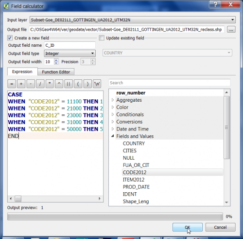
- In the processing toolbar, type Field calculator to browse for the QGIS --> Vector Table Tools --> Field calculator and open it.
- Define name and path of a new vector Output layer. Tick Create new field, specify the Output field name C_ID as Integer.
- Formulate 5 conditional operations creating a new vector file adding a new column named C_ID:
CASE
