Map validation
From AWF-Wiki
Contents |
QGIS Processing toolbox with OTB plugin
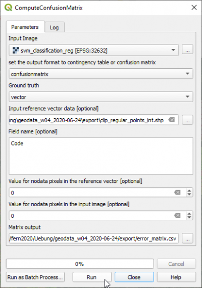
- Type into the search box of Processing tools Confusion and double click ComputeConfusionMatrix.
- Set the classified map as Input image.
- Select the output file name with the extension .csv under Matrix output.
- The validation data can be in vector or raster format. Select as Ground truth vector.
- Set the validation file CE_2020-01-03.shp as Input reference vector data.
- Set the Field name with the class code valid_clas.
- Click Run.
- Open the CSV output file with Libre Office Calc or MS Excel. Calculate User accuracies, Producer accuracies, Overall accuracy and Kappa index.
Accuracy assessment and area estimation with R
FAO implemented a map validation and stratified area estimation tool based on R, Rstudio and the Shiny package. The method is based on Olofsson et al. http://dx.doi.org/10.1016/j.rse.2012.10.031 2013], 2014) If not already installed on your laptop: install R, RStudio and Rtools. Start Rstudio and type into the console:
install.packages("shiny", dependencies = TRUE)
Create validation sample points with a stratified random sampling design
Start Rstudio and type:
library(shiny)
options(shiny.launch.browser = TRUE)
runGitHub("openforis/accuracy-assessment",subdir="aa_design")
Area estimation
Start Rstudio and type:
library(shiny)
options(shiny.launch.browser = TRUE)
runGitHub("openforis/accuracy-assessment",subdir="aa_analysis")
