Map validation
From AWF-Wiki
(Difference between revisions)
(→Orfeo Toolbox) |
(→QGIS Processing toolbox with OTB plugin) |
||
| Line 1: | Line 1: | ||
=== QGIS Processing toolbox with OTB plugin === | === QGIS Processing toolbox with OTB plugin === | ||
| − | + | # Type into the search box of Processing tools type {{typed|text=Confusion}} and double click '''ComputeConfusionMatrix'''. | |
# Set the classified map as {{button|text=Input image}}. | # Set the classified map as {{button|text=Input image}}. | ||
# Select the output file name with the extension '''.csv''' under {{button|text=Matrix output}}. | # Select the output file name with the extension '''.csv''' under {{button|text=Matrix output}}. | ||
Revision as of 16:25, 5 January 2020
QGIS Processing toolbox with OTB plugin
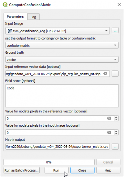
- Type into the search box of Processing tools type Confusion and double click ComputeConfusionMatrix.
- Set the classified map as Input image.
- Select the output file name with the extension .csv under Matrix output.
- The Ground truth reference data can be in vector or raster format. Select Ground truth as vector data file.
- Set the validation CE_2020-01-03.shp as Input reference vector data.
- Select the Field name valid_clas.
- Click Run.
- Open the CSV output file with Libre Office Calc or MS Excel. Calculate User accuracies, Producer accuracies, Overall accuracy and Kappa index.
