File:RemSens Exercise03 4.png
From AWF-Wiki
No higher resolution available.
RemSens_Exercise03_4.png (530 × 530 pixels, file size: 545 KB, MIME type: image/png)
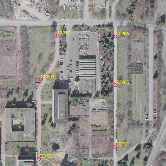
Aerial image of the faculty of forestry, Göttingen, with ground control points used for georeferencing in Exercise 03b: Georeferencing of the QGIS tutorial 2013/14.
File history
Click on a date/time to view the file as it appeared at that time.
| Date/Time | Thumbnail | Dimensions | User | Comment | |
|---|---|---|---|---|---|
| current | 19:24, 8 December 2013 | | 530 × 530 (545 KB) | Lburgr (Talk | contribs) | Aerial image of the faculty of forestry, Göttingen, with ground control points used for georeferencing in Exercise 03b: Georeferencing of the QGIS tutorial 2013/14. |
- Edit this file using an external application (See the setup instructions for more information)
File usage
The following page links to this file: